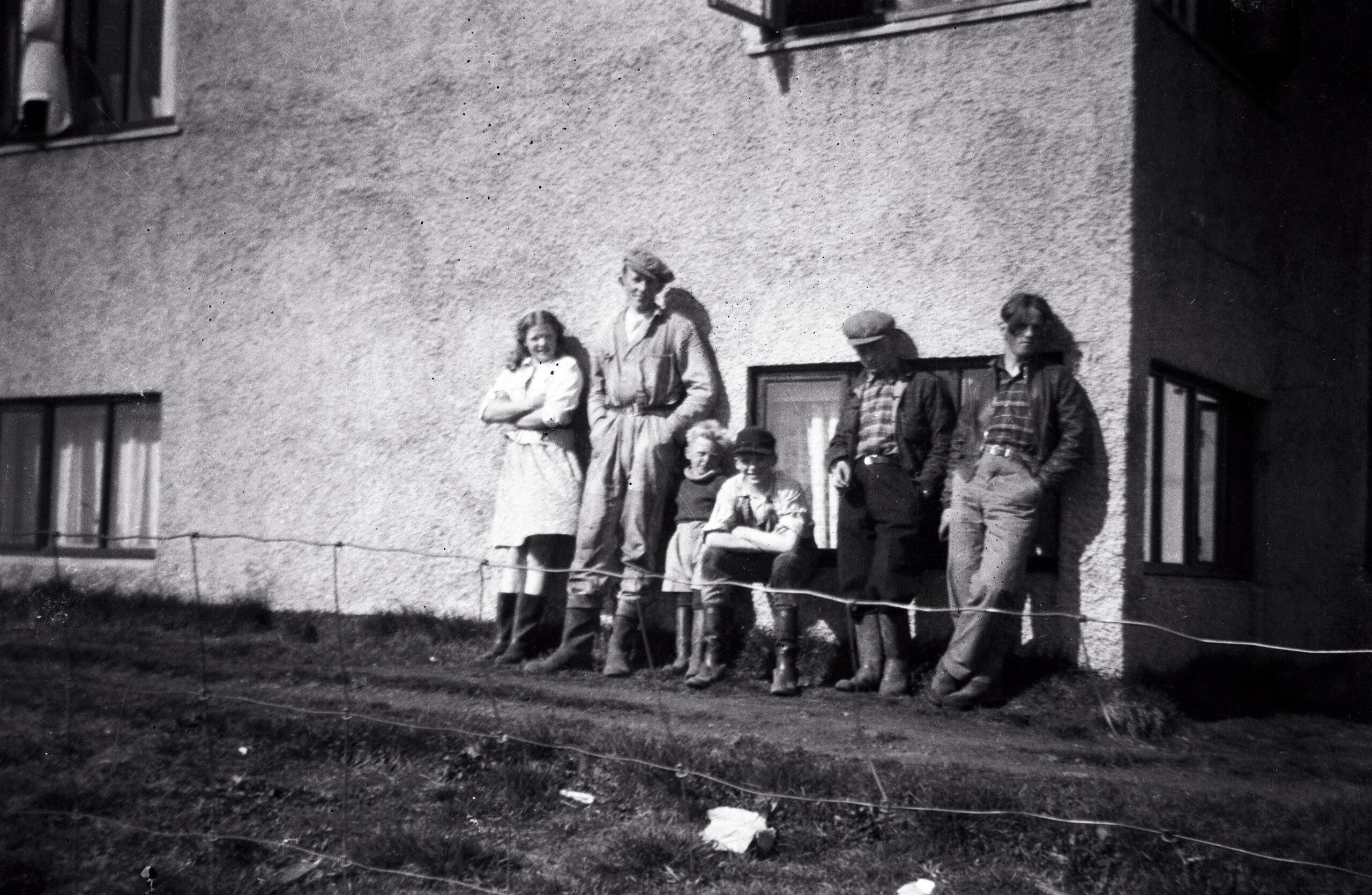
 Syðri-Reykir, sometime between 1945 and 1955. My father is the tall one in the coveralls; the others I have not yet identified — if you recognize anyone, I would be glad to hear it. Family archive.
Millions of people drive the Golden Circle every year. The version they get is tidy: a 300-kilometer loop from Reykjavík, three famous stops — a rift valley, a geyser, a waterfall — a photo at each, back in the city by dinner. None of it is wrong, exactly. But almost none of those visitors know the history of the land they are driving through.
I was born and raised in Biskupstungur, the farming district that holds both Geysir and Gullfoss. I spent my first twenty years here, and the decades since running a business in the district — which, in a place this size, means being involved with everyone: the farmers, the landowners, the families I went to school with. My father came to this district in 1935. Between his memory and mine, our family has watched this land for more than ninety years: the hayfields behind the parking lots, the sheep gathered every autumn, the neighbors, the funerals, the deals sealed with a handshake because paper would have felt like an insult. The tour buses drive through a landscape. I know it as a community.
This page is my attempt to write some of it down before it thins out. Call it a living archive: my family’s memories, our photographs going back to the 1940s, and documented local history from newspapers, annals, and survey records. My rule is simple. Where a story stands in the written record, I say so. Where it rests on memory — mine, my father’s, our neighbors’ — I say that too. A surprising amount of what the English-language sources repeat about these places is wrong, and I intend to correct it here, one story at a time.
The couple at the top of this page were photographed at Syðri-Reykir, the farm where my father worked. I don’t know who they are — perhaps someone reading this does. Behind them stand the mountains of the Golden Circle, and the notch in the ridge is Brúarárskörð, where the Brúará gathers before it runs down to Brúarfoss. Photographs like this are what this archive is made of.
I will keep adding to this page as new stories are ready. Here are the first five.
Strokkur’s Secret 1963 Reboot: The Drill That Brought Strokkur Back to Life
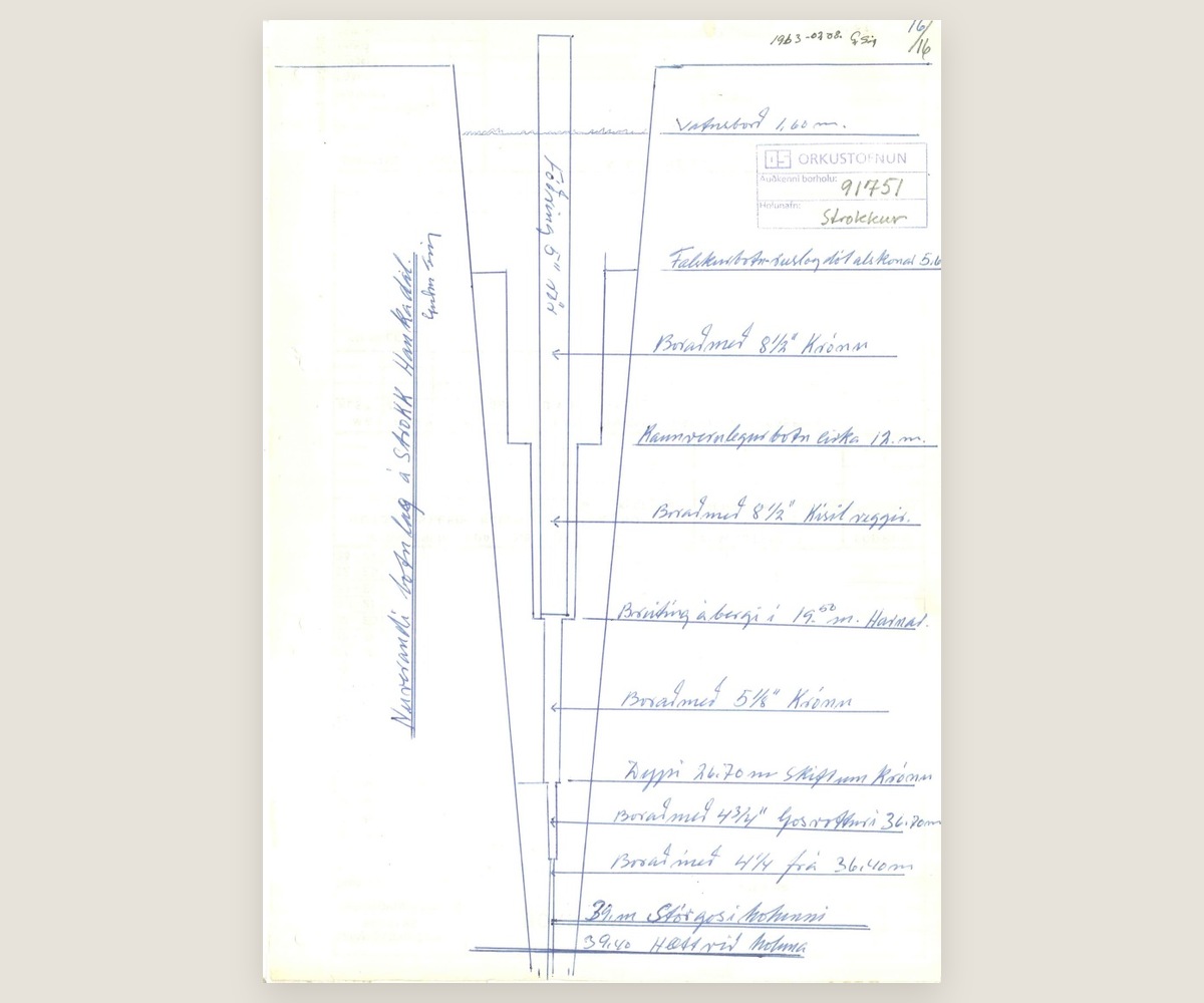 The Strokkur borehole in section, drawn 8 August 1963. The last two lines read „39 m stórgos í holunni“ — at 39 metres, a major eruption in the hole — and „39,40 hætt við holuna“, the hole abandoned at 39.40 metres. Orkustofnun, borehole 91751.
Strokkur in everyone’s photographs — erupting on schedule, every few minutes, all day long — spent most of a century as a hole in the ground. The earthquakes of 1896 rearranged its underground plumbing, and Strokkur went quiet. For sixty-seven years it sat there, a rubble-choked shaft that visitors walked past on their way to the great Geysir, which by then was barely erupting either.
Then, in July 1963, the Geysir Committee brought in a drill. A 39.4-meter borehole was sunk down through the blocked channel, and Strokkur came back to life. It has hardly paused since. The reliability that everyone credits to nature is, in part, engineering — and the locals have always known it. The full article tells the story properly: the silent decades, the committee and the drill, and why almost nobody mentions any of it today.
Read the full story: the 1963 drilling that brought Strokkur back →
Peningagjá in 1947: When the Money Fissure Was a Working Road
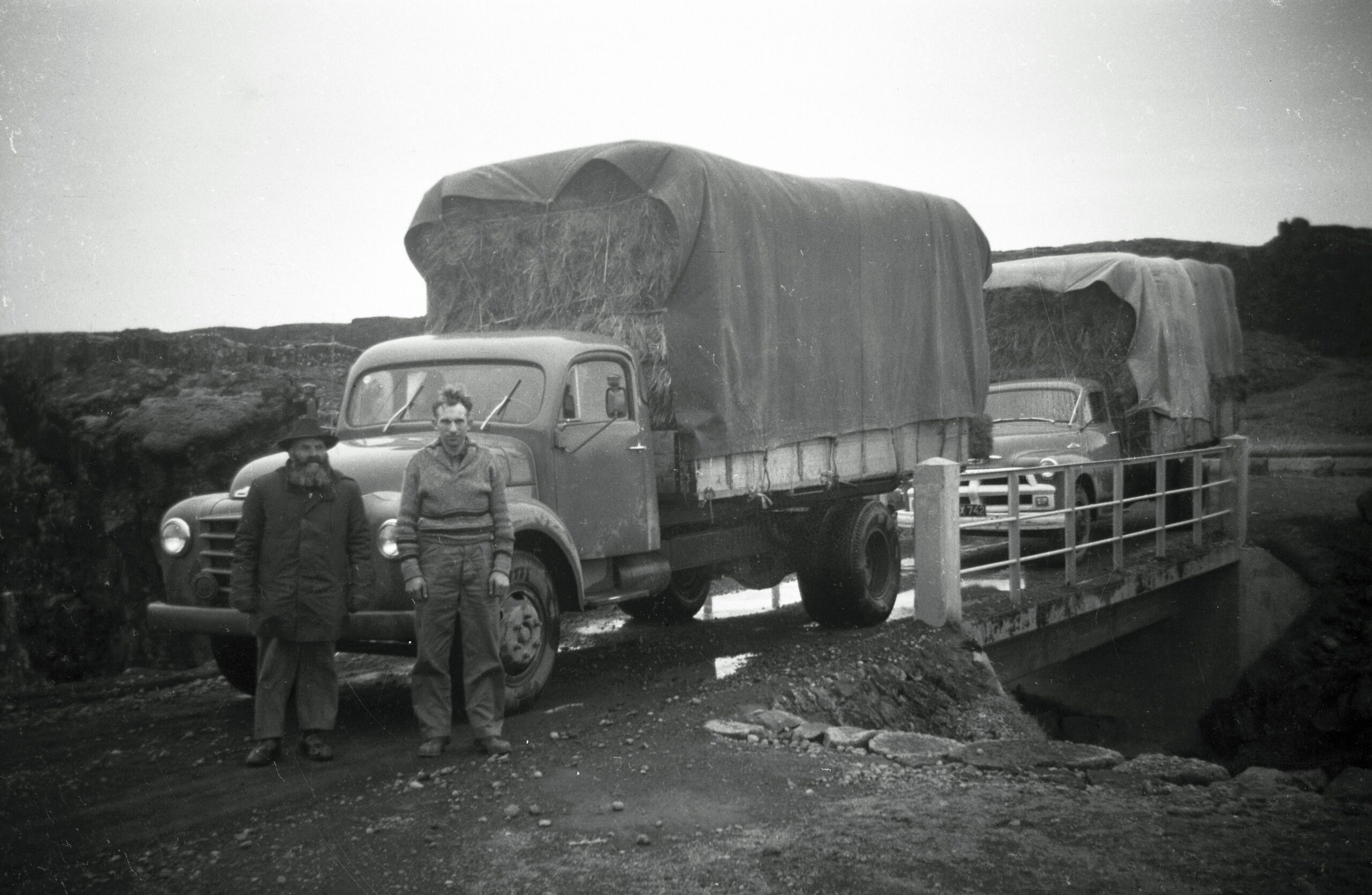 The hay transport, 1947. Húnbogi Hafliðason on the left; the man on the right is not yet identified. Photographed by my father. Family archive.
At Þingvellir, the guides tell Peningagjá as a wishing well: drop a coin into the clear water, watch it flash all the way down, make a wish. They will tell you the custom goes back to the Danish king’s visit in 1907, and that part is true enough.
What they don’t tell you is what happened after the king went home. For decades this was not a monument — it was a route, part of the working landscape that farmers crossed with animals and machinery. In 1947, in the middle of the rationing years, my father and Húnbogi Hafliðason drove a fully loaded hay truck over the fissure. Nobody was throwing money into the water that day; people were counting it. The full article follows Peningagjá from royal spectacle to farm road and back — and what that says about how quickly a place can be reinvented for visitors.
Read the full story: the real history of the Money Fissure →
Brúarfoss and the Broken Bridge: The 1602 Story Behind the Name
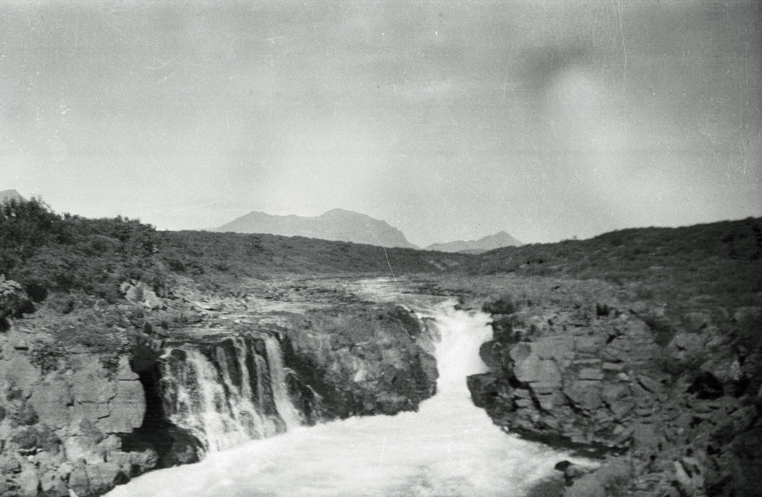 Brúarfoss, around 1950 — photographed by my father, long before the internet found the color. Family archive.
Brúarfoss is the waterfall people cross the world to photograph for its color — a deep, almost unreal blue that comes from spring-fed water, not glacial melt, whatever the captions say. But the name has nothing to do with the color. Brúarfoss means “bridge falls,” and there really was a bridge: a natural stone arch that once spanned the river.
In 1602, during a famine, a steward of the Skálholt estate had that bridge deliberately broken — to stop starving, displaced people from crossing the river and reaching the bishop’s seat. The arch was never restored. The name stayed. Every visitor who says “Brúarfoss” today is repeating the memory of something destroyed on purpose. The full article traces the bridge, the famine, and the thousand-year road that died in 1961.
The Hvítá River and the Brattholt Handshake: Rent Paid in Salmon
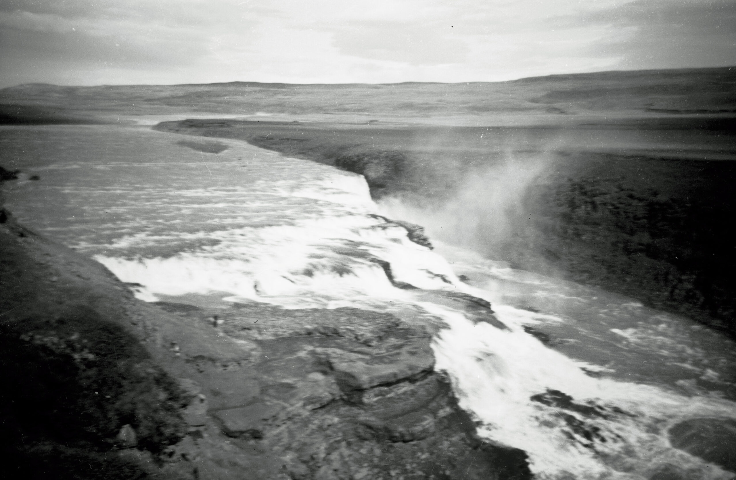 Gullfoss, photographed by my father. Family archive.
In the 1980s and 90s, my father and I fished for salmon in the Hvítá river, just south of Gullfoss. The stretch belonged to the farmer at Brattholt, and our rent was not a number. It was every third salmon we caught. No contract, no invoice, no reminder ever needed. That was the entire agreement, and it held for years.
I include this story not because anything dramatic happened — it didn’t — but because it shows how this district actually ran. Trust was the currency, and a man’s word carried further than his signature. The full article is about that stretch of river, the farm below the falls, and a way of doing business that never needed paper.
The One-Man Religion: A Faith Nobody Else Would Join
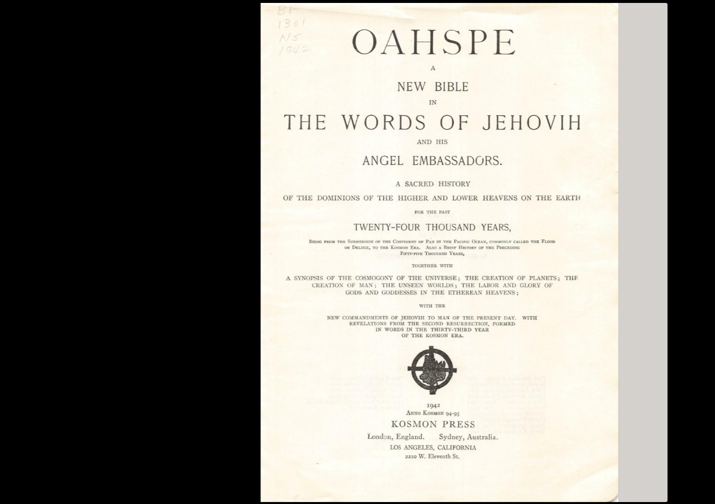 The book at the centre of the story. Public domain.
When I was a boy in Biskupstungur, one greenhouse farmer in the district had a religion that nobody else would join. The older people told us children that Njáll had made it up with his twin brother, that the brother had moved to America, and that now Njáll kept it alone. We knew it mostly through food: no meat, no fish, ever, because his faith forbade it.
For years that was all the story was. Then I found Njáll in print: in newspaper interviews from 1970 and 1974, and in a memoir published in 1996. The story was true. Where his faith came from was not what the district believed. The full article follows it from a wartime greenhouse in Laugarás, to a roadside in France, to a book printed on the other side of the world.
Read the full story: the one-man religion of the Golden Circle →
More Stories Are Coming
There are more stories from this district than one page can hold — some standing in written records, some living only in the memory of people I can still call. I publish each one when it is checked, dated, and where possible, photographed. If the Golden Circle is on your route, read a few of these first. The road looks different when you know what happened beside it.