

The One-Man Religion of the Golden Circle
On this page
- What the older people told us
- A teacher who believed in inspiration
- Twins at the first iron-frame greenhouse
- A truck on a road in France
- America, and a brother in LA
- A Parisian at Friedland
- Friðheimar as we knew it
- The 1974 interview: OAHSPE
- What the district got wrong
- How the faith of one ended
- A district of individualists
- Questions
- Sources
Every farming district has its characters. In Biskupstungur, when I was growing up, one of them was Njáll Þóroddsson. He was a greenhouse farmer who lived at Friðheimar in Reykholt, near the community hall Aratunga, and grew vegetables under glass like many of his neighbours. One thing set him apart from all of them. Njáll had a religion that nobody else in the district shared.
The older people explained it to us children simply. Njáll had his own faith. He had started it together with his twin brother, but the brother had moved to America, and now Njáll kept it alone.
We understood it best through food. Njáll’s son Haukur was in school with us. Njáll did not eat meat or fish, because his religion forbade it, and at home Haukur ate what his father ate. There was surely more to it, but what we children remember is skyr and cucumbers, and that other families in the district liked to give Haukur a hearty meal when he came by.
For years that was all the story was: something the grown-ups told us, half explanation and half warning. Then I found Njáll in print, three times over: in a Morgunblaðið interview from 1970, in a second interview from 1974, and in a 1996 article about a memoir written by his wife. The story was true. Parts of what we had been told were not, and the real one is stranger and sadder than the version we knew.
What the Older People Told Us
To the adults in the district, Njáll was a well-known figure. Everyone agreed he was strange, and he never hid what he believed. He had his own Bible, and he tried to convince anyone who would listen that it held the only true faith.
Nobody was convinced. Over the years many people came to work for him, and they listened, did not believe, and eventually gave up the argument. No one in Biskupstungur ever joined him.
That is how the story reached us: two brothers who made up a religion of their own. One of them left, and the other kept it alone.
A Teacher Who Believed in Inspiration
Njáll did not start out as a grower. He was a teacher, and taught for many years in schools in South Iceland, the last of them in Mýrdalur, near Vík, where he told a journalist he had been happy.
He was also, from early on, a man who took guidance from somewhere other than the people around him. In 1947 he bought a piece of land in Reykholt: about 2,000 square metres of waterlogged bog. He had no particular plan for it. “In my eyes there is nothing strange about that,” he told Morgunblaðið in 1970. “I believe in inspiration and guidance from beyond.” Later, he said, the same inspiration told him to settle there.
In 1954 he planted 1,800 trees on the bog. He had not forgotten that nobody noticed: “The mayor of Reykjavík planted one tree in Heiðmörk and got his picture in the papers. I planted 1,800 trees in 1954, and no picture was ever taken of me.”
Twins at Iceland’s First Iron-Frame Greenhouse
Njáll had a twin, Þór. The Laugarás local history names them both, Þór and Njáll Þóroddssynir, as twin brothers who worked as gardeners in Laugarás, the hot-spring settlement on the Hvítá river not far from Reykholt, and notes that Njáll later lived at Friðheimar.
The place they worked has its own story. In 1942, in the middle of the Second World War, the physician Sigurður Sigurðsson, then Iceland’s chief tuberculosis doctor and later its Director of Health, built a small summer house in Laugarás. According to the Laugarás history, the original reason was that he wanted a refuge for his family in case Reykjavík was bombed. Beside it he put up a 300 square metre greenhouse, which the same source describes as probably the first iron-frame greenhouse built in Iceland. The twins were among the gardeners who worked in it.
“Tarzan”
One story from those years survived long enough to reach me. In Laugarás, Njáll was known as Tarzan, because he worked out in the fields in nothing but his swimming trunks. As it turns out, that was how he would meet his wife.
A Truck on a Road in France
In the district we knew Njáll had a bad back, and I had always heard it came from a motorcycle accident in France. The 1970 interview tells it differently, and its author was there.
The journalist, Elín Pálmadóttir, was working at the Icelandic embassy in Paris in 1950. On 9 August that year the embassy got a call: an Icelander had been in a road accident in the south of France and was lying in a Catholic hospital, barely expected to live. He had been travelling by bicycle when a large truck hit him and dragged him a long way. The gravel tore away the muscles of his back and thighs.
That was her first meeting with Njáll. He survived and reached Paris before Christmas, but he was assessed as 40 percent disabled for life. Muscle does not grow back, and for the rest of his life he struggled with his back and tired easily at work. It is why he always needed people working for him.
America, and a Brother in Los Angeles
The district’s story sent Njáll’s twin to America. The newspapers show that Njáll went there too. In 1970 he told Morgunblaðið he had spent time in America studying “a certain philosophical teaching”, and that around 1956 he had thought about emigrating for good.
He stayed. Þór did not. Þór settled in Los Angeles, and he is the reason the Los Angeles connection runs through the rest of this story. Njáll later said it was through Þór in Los Angeles that he got to know yoga, which he practised for a time in America and meant to take up again. And it was from a publisher in Los Angeles that he ordered the book that became his faith.
A Parisian at Friedland
In 1963 a 23-year-old woman from Paris named Liliane Zilberman was travelling around Iceland alone. On the classic bus route past Gullfoss, Geysir and Þingvellir, she ended up stranded on a country road near Gullfoss, with nobody who could understand her. Njáll had heard there was a foreigner in trouble and came to help. He drove her to Gullfoss and Geysir himself.
Decades later, in her memoir, she described the first sight of him walking towards her: bare to the waist in the sun, in old work trousers, with his shirt tied round his middle by the sleeves. “He is tall, fair-haired, badly shaven,” she wrote, “in truth a very handsome man.” The district’s Tarzan, seen through the eyes of a Parisian.
Liliane’s family were from Eastern Europe. Her father was a doctor, and during the war they had sheltered from Nazi persecution in the mountains of southern France. She had studied pharmacy in Paris. Njáll was almost twenty years older. They wrote to each other after she left, and in September Njáll came to Paris and they married at the city hall. Instead of going straight home, they took a 72-day cruise from Southampton, round Africa to Australia, Tahiti and Mexico, and back through the Panama Canal.
Friedland, or Friðarheimar
When Morgunblaðið visited in August 1970, the bog Njáll bought in 1947 was unrecognisable. The journalist described turning off the main road onto a private drive and coming suddenly on a flower garden: 6,000 flowering pansies, with nemesias, chrysanthemums, snapdragons and orchids, set among lawns and stone walls, and a large house on a slope above. This, she wrote, was not a description of a house in Hollywood, but in Biskupstungur. The couple called their house Friedland, or Friðarheimar: homes of peace.
Njáll had five greenhouses, 2,000 square metres in all, growing mostly tomatoes and cucumbers. In summer he had staff, among them a French boy. In winter the couple were alone.
The pool with the stone arch
In front of the house was a swimming pool, 55 metres long, fed with the runoff water from the house’s heating. Njáll had just cast a stone arch over it. A photograph from 1970 shows Njáll, Liliane and a small boy sitting on that arch.
That arch must be the “bricks over the pool” I remember from childhood, which to us children was the most interesting thing on the farm.
A little prince in the castle
The small boy on the arch was Haukur. “Now a little prince has come to the palace,” the journalist wrote. He had joined the household the Christmas before, three years old, after Njáll and Liliane had spent several years trying to adopt a child in Iceland, France and Germany. They hoped to take more.
Friðheimar as We Knew It
As children we were nervous about going to Friðheimar. Njáll kept a dog we were sure was dangerous, and that alone made the place hard to reach. It was hard to reach in another way too: Njáll was known in the district for having no telephone. If you wanted to speak to him, you went there.
There were always people working in the greenhouses, because Njáll’s back would not let him do it alone, and there was always the conversation about his faith. By then it had a name.
The 1974 Interview: OAHSPE
On 2 June 1974, Lesbók Morgunblaðsins, the paper’s Sunday supplement, published a two-page interview in a series on religious experience. Elín Pálmadóttir had come back to Friðheimar, this time to ask about Njáll’s faith. The headline was a line of his:
“Erum á leið inn í ljóssvæði — því er öll þessi upplausn.”
We are on our way into a zone of light. That is why there is all this upheaval.
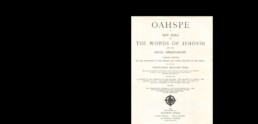
The photograph shows Njáll in a white sweater with Haukur, now a small boy in a patterned Icelandic sweater, on his knee, and a thick book in his hands. The caption names it: the great book, OAHSPE. The journalist writes that all she knew beforehand was that Njáll followed a religion almost unknown in Iceland and, because of it, ate only vegetables. Njáll was convinced her visit was no coincidence. He believed she had been sent by higher powers to make his faith known.
A new bible from New York
Oahspe: A New Bible was published in the United States in 1882. Its author, the New York dentist John Ballou Newbrough, said he wrote it by automatic writing on one of the first typewriters, before sunrise every morning for a whole year, without knowing what he was writing. Its followers call themselves Faithists, and a vegetable-only diet is one of its central teachings. According to the interview, small groups in the United States and Britain followed it in 1974.
How Njáll found it
Njáll said he had read metaphysical books for years. He had studied the ideas of the Icelandic thinker Helgi Pjeturss, looked into theosophy and gone to séances in his school years. Then a book he had ordered from Los Angeles arrived in the post. He read it, put it aside for four or five years, and could not get past it. Some people called it a science-fiction thriller, he said, but he could find nothing in it he could argue against.
What Njáll believed
Much of the interview is Njáll explaining the book: an almighty Creator above everything, spirit worlds around the earth, and a history of humanity running through cycles of darkness and light of about 3,000 years each. By his reading, the earth was just then entering a zone of light, which explained the upheaval in the news. Giving up meat and fish was one step in purifying yourself, because the spiritual body was not content with food that had blood in it. He admitted it was hard to live on vegetables in Iceland.
Parts of it read like science fiction, and Njáll knew people said so. In his account, humanity began when an “archangel” came to earth in a spaceship to raise up early man. 450,000 years ago, ten million volunteers followed in spaceships to lift the people of earth towards higher thought.
For all that, he did not present himself as a prophet. Asked what he himself did, he answered:
“Ég geri ekkert. Ég bíð og er alltaf að burðast við að þroska mig … Sjálfur er ég ekkert — bara venjulegur maður.”
I do nothing. I wait, and I keep struggling to develop myself. I am nothing myself, just an ordinary man.
He cooked the journalist a meal of many kinds of vegetables, with plant-based ice cream for dessert. The interview ends with Njáll and little Haukur walking her out to her car.
What the District Got Right, and What It Did Not
Put the newspapers next to what we were told as children, and most of the story holds. Njáll held a faith almost nobody in Iceland had heard of. It ruled out meat and fish. He was sure it was the true one. And he held it alone.
What the district got wrong is where the faith came from. Njáll did not invent his religion, and there is nothing in the record to say his twin shared it. His Bible was a real book, printed in America in the 1880s, and it reached him from Los Angeles, the city where Þór lived. The district remembered two brothers who founded a faith. The newspapers show one brother who found a faith, and another who was the reason it reached Iceland at all.
Starships, and a Darker Comparison
The vocabulary in Njáll’s book matters. Oahspe describes graded heavens that souls rise through, and beings who travel between worlds in ships of light. Its author is credited with possibly being the first person to use the word “starship”. Ideas of this kind, with spirit hierarchies, levels above the human and visitors arriving by ship, later became common ground for the movements now grouped together as UFO religions.
The best known of them is Heaven’s Gate, the American group led by Marshall Applewhite and Bonnie Nettles, known to their followers as Do and Ti, a movement that did not leave a good name behind it. There is no direct historical link between Heaven’s Gate and Oahspe, and the Faithists who follow Oahspe are a small and peaceful movement. The family resemblance is still easy to see: renunciation of the body, a level above the human, and ships from the heavens.
In Biskupstungur, people have drawn that comparison themselves. When Njáll’s story comes up today, locals say it was a good thing his faith never took root in the district.
How the Faith of One Ended
In 1996 Liliane published her memoir in Icelandic, Bláu trén í Friðheimum (The Blue Trees at Friðheimar), translated by Sigurlaug Bjarnadóttir. The newspaper Alþýðublaðið summed it up: a love story and an adventure that turned into a tragedy.
Liliane is clear that the faith was part of it. When she met Njáll, she wrote, he belonged to the national church without being a churchgoer, but he talked often about the book Oahspe. That interest, the paper noted, played its part in the tragedy that led to their separation. Liliane went back to France. Njáll stayed at Friðheimar with Haukur.
Her memoir also gives the plainest confirmation of the one-man religion anywhere in print:
“Njáli tókst ekki að afla Oahspe fylgis eða ná saman neinum hópi um þessa kenningu.”
Njáll never managed to win followers for Oahspe, or to gather any group around its teaching.
When illness overtook Njáll in his later years, the ties to Friðheimar were cut. Haukur went to Litla-Fljót, a farm close by, where Júlíana and Halldór took him in and, in Liliane’s words, cared for him as their own child. When Liliane came back to Iceland in 1994 for the first time since the separation, Njáll was in a nursing home, and the house at Friðheimar stood neglected. Of Haukur, grown up by then, she wrote that he bore no bitterness, “because he is good and warm-hearted.”
A Faith of One, in a District of Individualists
It would be easy to tell this as a joke. The district never quite did. People said Njáll was strange, and said it often. They also worked in his greenhouses, listened to him talk about his faith, fed his son, and in the end took that son in and raised him.
That is Biskupstungur in those decades: a farming district of independent people who made their own decisions, and a community small enough that it had to live with every one of them. A man who settled on a bog because he felt guided to, planted 1,800 trees on it, built a 55-metre pool in the countryside and followed a bible from New York was an extreme case of the first. The family at Litla-Fljót is the second.
The Golden Circle is a coach route today. But the district it runs through was shaped by people like Njáll Þóroddsson: a teacher, a twin, a gardener in what was probably Iceland’s first iron-frame greenhouse, the survivor of a roadside accident in France, and for the rest of his life the only member of his faith. His religion ended with him. The district still tells his story.
This story is part of The Untold Stories of the Golden Circle. Other stories from the same district include why Strokkur stopped erupting, the hidden history of Peningagjá at Þingvellir and the history of Gullfoss and the Hvítá river.
Frequently Asked Questions
What was the one-man religion of the Golden Circle? The faith of Njáll Þóroddsson, a greenhouse farmer at Friðheimar in Reykholt, Biskupstungur. Locals believed he and his twin brother had invented it. Newspaper interviews from 1970 and 1974 show it was Oahspe, a 19th-century American scripture. His wife’s 1996 memoir confirms he never won a single follower.
What is Oahspe? Oahspe: A New Bible, published in the United States in 1882 by John Ballou Newbrough, a New York dentist who said he wrote it by automatic writing. Its followers are called Faithists, and it teaches a vegetable-only diet.
Was Njáll’s religion connected to Heaven’s Gate? Not directly. There is no organisational or historical link between Oahspe and Heaven’s Gate, the American UFO group led by Do and Ti. Oahspe’s ideas of graded heavens and ships of light belong to the same broad family of beliefs, which is why locals in Biskupstungur sometimes make the comparison.
Who was Njáll Þóroddsson? A teacher in South Iceland who bought land in Reykholt in 1947, worked as a gardener in Laugarás with his twin brother Þór, and built up a greenhouse farm and garden at Friðheimar with his French wife Liliane.
What was Friðheimar called in Njáll’s time? In 1970 Njáll and Liliane called their house Friedland, or Friðarheimar, meaning homes of peace.
Where was Iceland’s first iron-frame greenhouse? Probably in Laugarás, Biskupstungur, according to the local history there. The physician Sigurður Sigurðsson built it at his wartime refuge from 1942. The twins Njáll and Þór were among its gardeners.
Sources
- E.P. (Elín Pálmadóttir), “Friðheimar í Biskupstungum. Þar hafa Njáll og Lilian búið um sig innan um tré og blóm,” Morgunblaðið, 187. tölublað, 21 August 1970, pp. 10–11. Available on Tímarit.is (in Icelandic).
- Elín Pálmadóttir, “Erum á leið inn í ljóssvæði — því er öll þessi upplausn. Viðtal við Njál Þóroddsson garðyrkjubónda um trú hans — OAHSPE,” Lesbók Morgunblaðsins, 15. tölublað, 2 June 1974, pp. 12–13. Available on Tímarit.is (in Icelandic).
- “Bláu trén í Friðheimum,” Alþýðublaðið, 4 December 1996, p. 6, on Liliane Zilberman Þóroddsson’s memoir Bláu trén í Friðheimum, trans. Sigurlaug Bjarnadóttir (Fjölvaútgáfan, 1996). Available on Tímarit.is (in Icelandic).
- Laugarás local history, “Krosshóll / Sigurðarstaðir 1942”: Sigurður Sigurðsson’s wartime refuge, the iron-frame greenhouse and the twins Þór and Njáll Þóroddssynir (in Icelandic).
- Wikipedia, “Oahspe: A New Bible”: author, publication and teachings.
- Robert Robertsson: childhood memories of Biskupstungur, and what older people in the district told him.

The Untold Stories of the Golden Circle: A Local's Living Archive
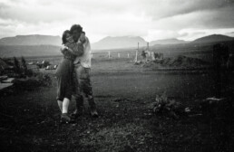
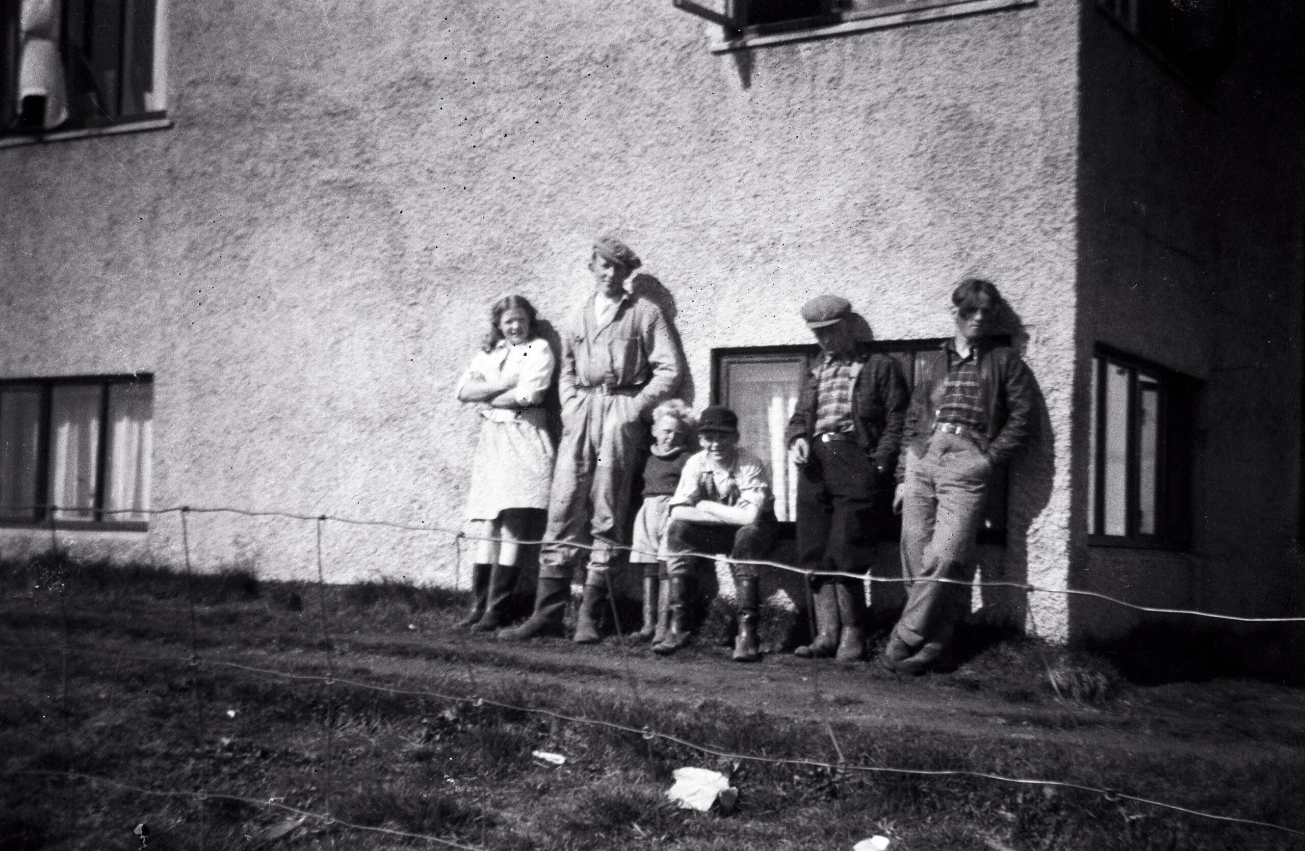 Syðri-Reykir, sometime between 1945 and 1955. My father is the tall one in the coveralls; the others I have not yet identified — if you recognize anyone, I would be glad to hear it. Family archive.
Millions of people drive the Golden Circle every year. The version they get is tidy: a 300-kilometer loop from Reykjavík, three famous stops — a rift valley, a geyser, a waterfall — a photo at each, back in the city by dinner. None of it is wrong, exactly. But almost none of those visitors know the history of the land they are driving through.
I was born and raised in Biskupstungur, the farming district that holds both Geysir and Gullfoss. I spent my first twenty years here, and the decades since running a business in the district — which, in a place this size, means being involved with everyone: the farmers, the landowners, the families I went to school with. My father came to this district in 1935. Between his memory and mine, our family has watched this land for more than ninety years: the hayfields behind the parking lots, the sheep gathered every autumn, the neighbors, the funerals, the deals sealed with a handshake because paper would have felt like an insult. The tour buses drive through a landscape. I know it as a community.
This page is my attempt to write some of it down before it thins out. Call it a living archive: my family’s memories, our photographs going back to the 1940s, and documented local history from newspapers, annals, and survey records. My rule is simple. Where a story stands in the written record, I say so. Where it rests on memory — mine, my father’s, our neighbors’ — I say that too. A surprising amount of what the English-language sources repeat about these places is wrong, and I intend to correct it here, one story at a time.
The couple at the top of this page were photographed at Syðri-Reykir, the farm where my father worked. I don’t know who they are — perhaps someone reading this does. Behind them stand the mountains of the Golden Circle, and the notch in the ridge is Brúarárskörð, where the Brúará gathers before it runs down to Brúarfoss. Photographs like this are what this archive is made of.
I will keep adding to this page as new stories are ready. Here are the first five.
Strokkur’s Secret 1963 Reboot: The Drill That Brought Strokkur Back to Life
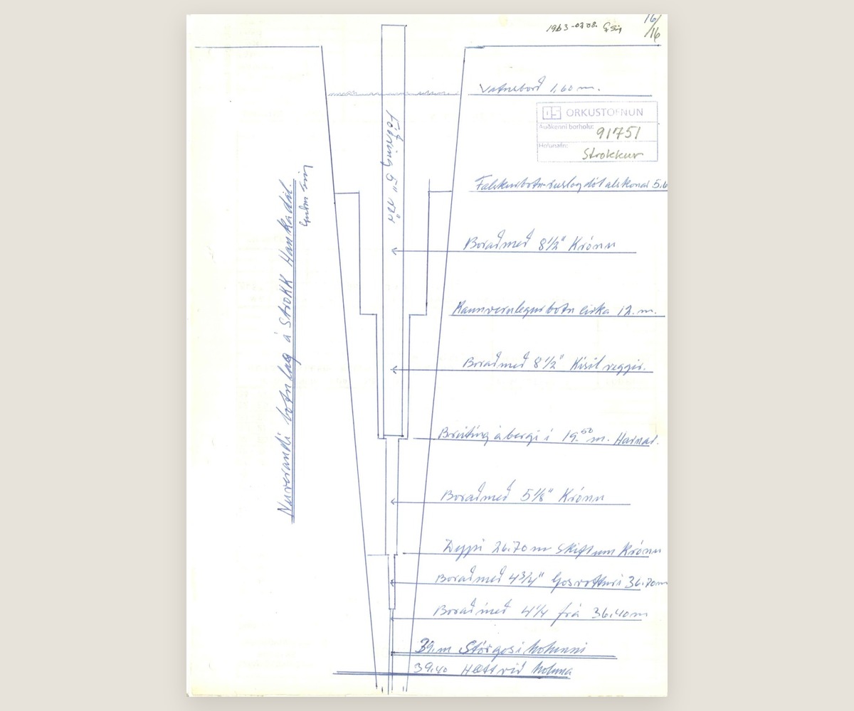 The Strokkur borehole in section, drawn 8 August 1963. The last two lines read „39 m stórgos í holunni“ — at 39 metres, a major eruption in the hole — and „39,40 hætt við holuna“, the hole abandoned at 39.40 metres. Orkustofnun, borehole 91751.
Strokkur in everyone’s photographs — erupting on schedule, every few minutes, all day long — spent most of a century as a hole in the ground. The earthquakes of 1896 rearranged its underground plumbing, and Strokkur went quiet. For sixty-seven years it sat there, a rubble-choked shaft that visitors walked past on their way to the great Geysir, which by then was barely erupting either.
Then, in July 1963, the Geysir Committee brought in a drill. A 39.4-meter borehole was sunk down through the blocked channel, and Strokkur came back to life. It has hardly paused since. The reliability that everyone credits to nature is, in part, engineering — and the locals have always known it. The full article tells the story properly: the silent decades, the committee and the drill, and why almost nobody mentions any of it today.
Read the full story: the 1963 drilling that brought Strokkur back →
Peningagjá in 1947: When the Money Fissure Was a Working Road
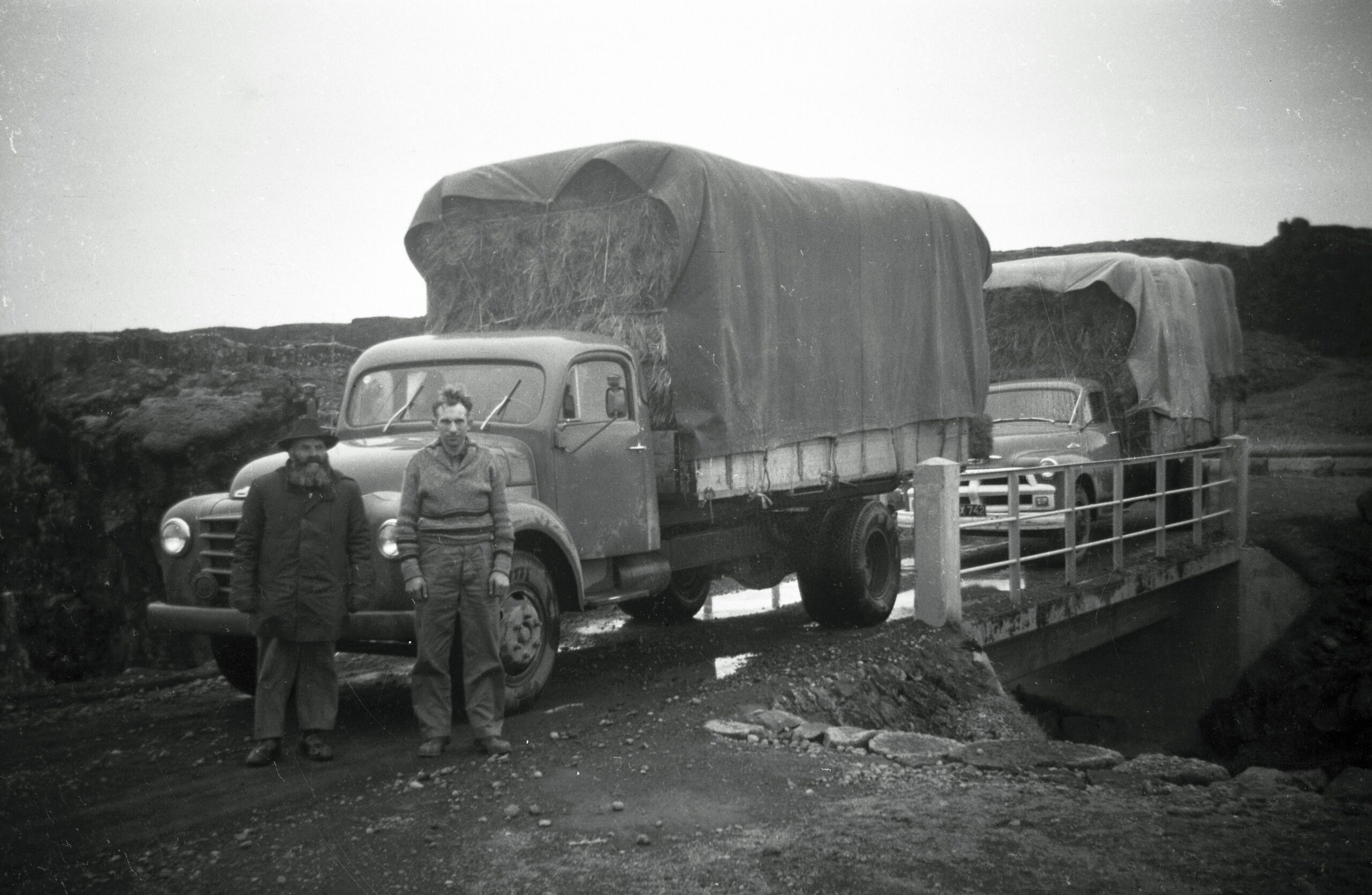 The hay transport, 1947. Húnbogi Hafliðason on the left; the man on the right is not yet identified. Photographed by my father. Family archive.
At Þingvellir, the guides tell Peningagjá as a wishing well: drop a coin into the clear water, watch it flash all the way down, make a wish. They will tell you the custom goes back to the Danish king’s visit in 1907, and that part is true enough.
What they don’t tell you is what happened after the king went home. For decades this was not a monument — it was a route, part of the working landscape that farmers crossed with animals and machinery. In 1947, in the middle of the rationing years, my father and Húnbogi Hafliðason drove a fully loaded hay truck over the fissure. Nobody was throwing money into the water that day; people were counting it. The full article follows Peningagjá from royal spectacle to farm road and back — and what that says about how quickly a place can be reinvented for visitors.
Read the full story: the real history of the Money Fissure →
Brúarfoss and the Broken Bridge: The 1602 Story Behind the Name
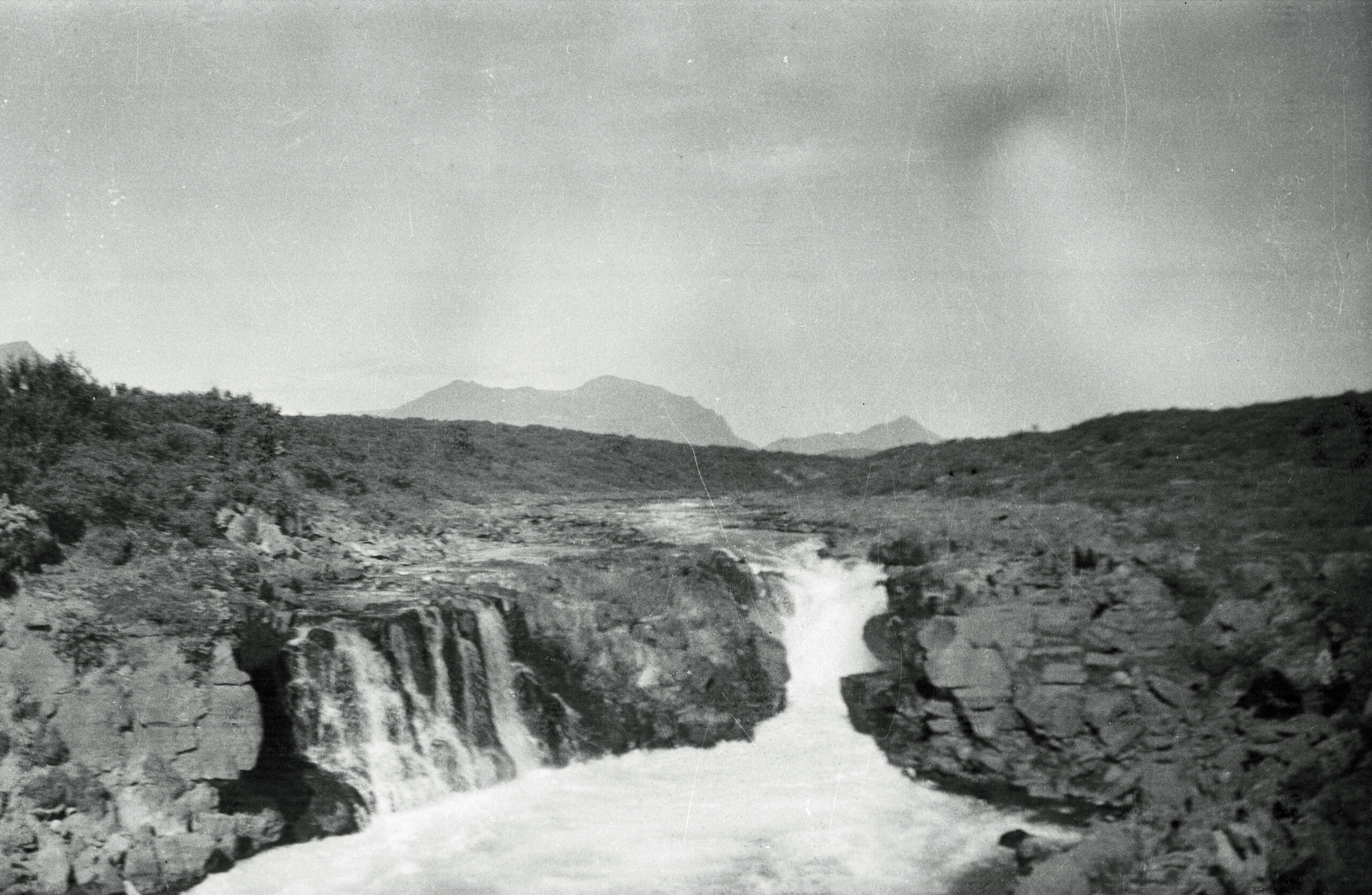 Brúarfoss, around 1950 — photographed by my father, long before the internet found the color. Family archive.
Brúarfoss is the waterfall people cross the world to photograph for its color — a deep, almost unreal blue that comes from spring-fed water, not glacial melt, whatever the captions say. But the name has nothing to do with the color. Brúarfoss means “bridge falls,” and there really was a bridge: a natural stone arch that once spanned the river.
In 1602, during a famine, a steward of the Skálholt estate had that bridge deliberately broken — to stop starving, displaced people from crossing the river and reaching the bishop’s seat. The arch was never restored. The name stayed. Every visitor who says “Brúarfoss” today is repeating the memory of something destroyed on purpose. The full article traces the bridge, the famine, and the thousand-year road that died in 1961.
The Hvítá River and the Brattholt Handshake: Rent Paid in Salmon
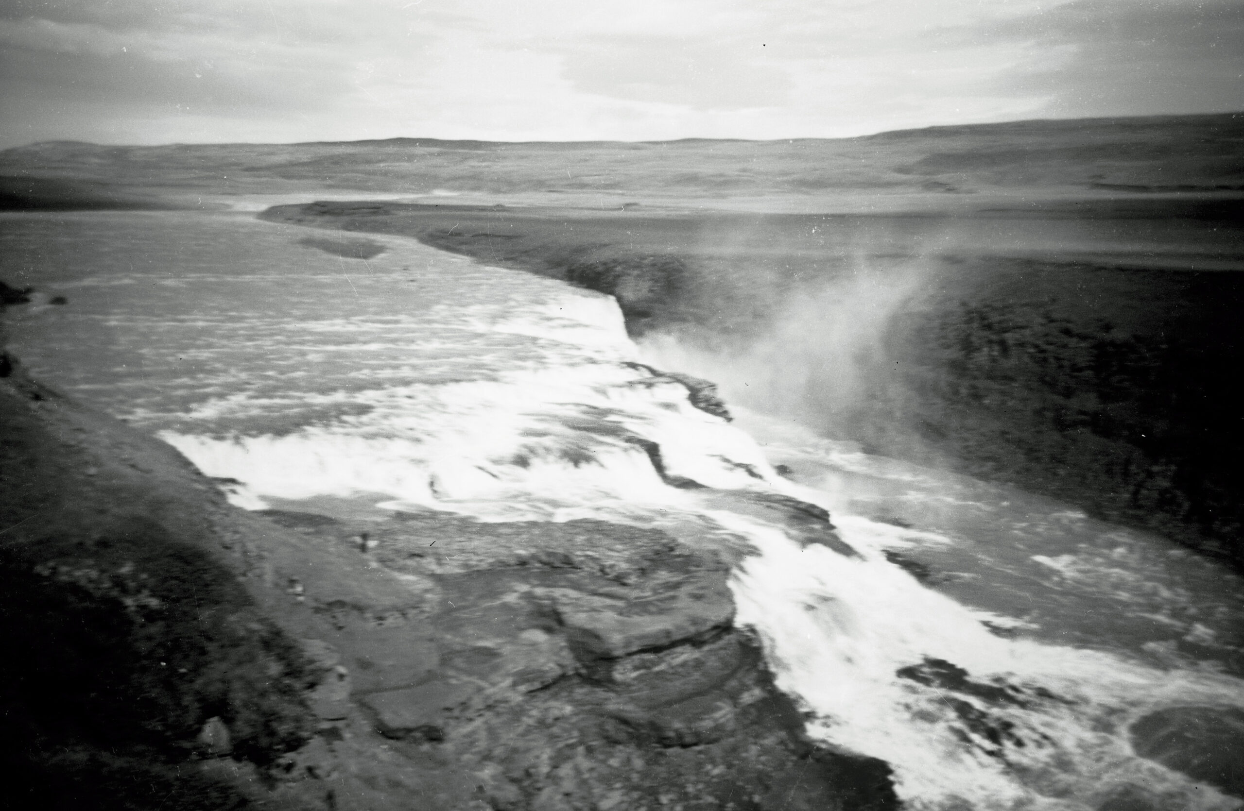 Gullfoss, photographed by my father. Family archive.
In the 1980s and 90s, my father and I fished for salmon in the Hvítá river, just south of Gullfoss. The stretch belonged to the farmer at Brattholt, and our rent was not a number. It was every third salmon we caught. No contract, no invoice, no reminder ever needed. That was the entire agreement, and it held for years.
I include this story not because anything dramatic happened — it didn’t — but because it shows how this district actually ran. Trust was the currency, and a man’s word carried further than his signature. The full article is about that stretch of river, the farm below the falls, and a way of doing business that never needed paper.
The One-Man Religion: A Faith Nobody Else Would Join
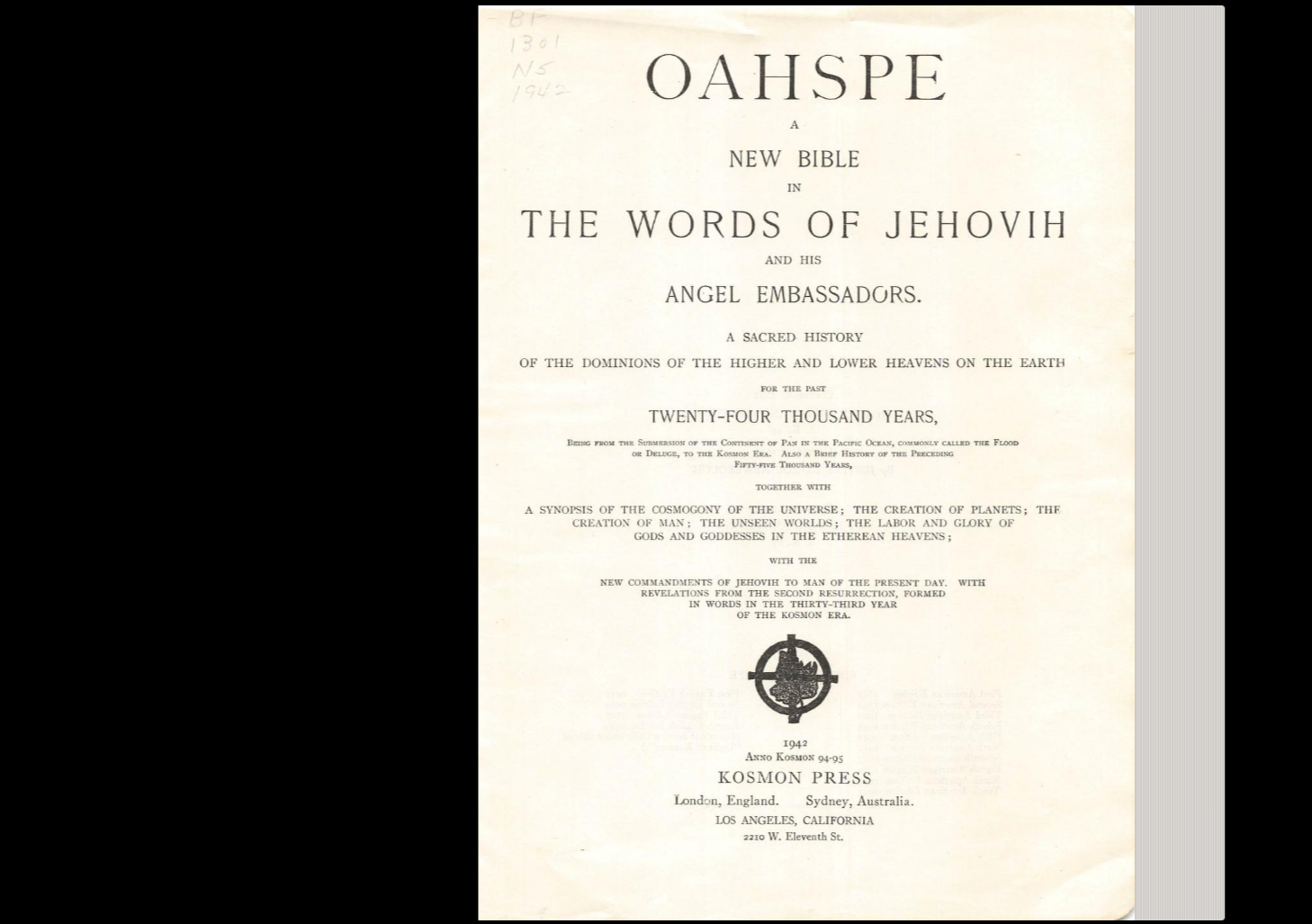 The book at the centre of the story. Public domain.
When I was a boy in Biskupstungur, one greenhouse farmer in the district had a religion that nobody else would join. The older people told us children that Njáll had made it up with his twin brother, that the brother had moved to America, and that now Njáll kept it alone. We knew it mostly through food: no meat, no fish, ever, because his faith forbade it.
For years that was all the story was. Then I found Njáll in print: in newspaper interviews from 1970 and 1974, and in a memoir published in 1996. The story was true. Where his faith came from was not what the district believed. The full article follows it from a wartime greenhouse in Laugarás, to a roadside in France, to a book printed on the other side of the world.
Read the full story: the one-man religion of the Golden Circle →
More Stories Are Coming
There are more stories from this district than one page can hold — some standing in written records, some living only in the memory of people I can still call. I publish each one when it is checked, dated, and where possible, photographed. If the Golden Circle is on your route, read a few of these first. The road looks different when you know what happened beside it.

Bruarfoss Waterfall: Why It's Blue, and the Bridge Under the Water
This story is part of The Untold Stories of the Golden Circle — a local’s living archive of the district.
Most people see Brúarfoss — often written Bruarfoss — before they hear the name. It is one of the images Iceland travels on: pale blue water folding into a narrow rift in dark rock, photographed from a small wooden footbridge between Laugarvatn and Geysir.
Almost nobody standing on that footbridge knows they are standing at a road.
For something close to a thousand years this was a crossing — the place where you got over Brúará and into the district beyond. It is the reason the river has the name it has, the reason the waterfall has the name it has, the reason a famine in 1602 turned violent here, and the reason a Danish king and two parliaments came through in 1907. The waterfall itself was incidental to all of it. Nobody came to look at the water. They came because this was the way across.
Then in 1961 the crossing moved four to five kilometres downstream, and Brúarfoss went quiet for fifty years — until photographs found it, and nobody who came knew it had ever been anything but a view.
Why You Could Not Simply Wade
Start with the question most people actually arrive with, because the answer is also the reason any of this happened.
Brúará is not a glacial river. It is spring-fed, rising out of the ground at Rótarsandur, and the water reaching Brúarfoss has never been near Langjökull — a detail most descriptions get wrong.
That is the whole explanation for the colour. A glacial river carries suspended rock flour and runs opaque grey-green. Brúará runs clear, and what you are looking at is clean water over dark volcanic rock, with the depth of the rift concentrating the blue. It is the opposite process from glacial milk, which is why Brúará looks like this while Hvítá, a short distance east, does not.
The geologist Guðmundur Kjartansson, who studied this stretch of river closely in the 1940s, called Brúará one of the most pronounced spring rivers of its size in the whole country. It never rises violently, and it does not freeze until well below Brúarfoss. Its flow, he wrote, is exceptionally steady whatever the weather does.
Which is also why there had to be a crossing. A glacial river swells with summer melt and falls away in autumn; sooner or later you can wade it. Brúará does not oblige. A river like that either stops you or gets bridged.
At the falls it was bridged, by the river itself. A natural stone arch spanned the water where it narrows into the rift.
The Name Is the Evidence
The older form of the name is Brúarárfoss — the waterfall of Brúará. And Brúará means bridge-river.
Read that in order and it tells you the whole history. The crossing came first. The river was named after the crossing. The waterfall was named after the river.
So the most famous natural feature on this stretch of water is named, at one remove, after a piece of infrastructure. English descriptions usually collapse this into a single step and end up muddling what was named after what. The extra syllable in the older form is the giveaway.
Whose Crossing It Was
Biskupstungur is the tongue of land between Brúará on the west and Tungufljót on the east. The district is defined by its water — which means a crossing on Brúará is not a convenience. It is the door.
Landnámabók records that Ketilbjörn the Old came from Naumudalur in Norway in a ship called Elliði, landed at the river mouth in Reykjavík that still carries the ship’s name, and rode inland looking for land. He claimed all of Grímsnes up from Höskuldslækur, all of Laugardalur and the whole of Biskupstunga up to Stakksá, and settled at Mosfell. His son was Teitur, his grandson Gissur the White, and his great-grandson Ísleifur — the first bishop of Iceland, at Skálholt, downstream on this same river.
So from very early on, the crossing at Brúarfoss belonged to whoever held the land beyond it. For most of the following centuries, that was Skálholt.
1602: The Crossing Is Broken on Purpose
You only bother to destroy a bridge that people are using.
The oldest written account comes from Jón Halldórsson of Hítardalur, in his Biskupasögur. In the hard years around 1602, he says, destitute and displaced people were coming to Skálholt from every direction in great numbers. The steward of the estate judged that the pressure would ease if the natural stone arch on Brúará — the one the river was named for — were broken. He had it done with a work crew, with the knowledge, if not the counsel, of the bishop’s wife Helga Jónsdóttir, but without the knowledge of Bishop Oddur, who took it very badly when he learned of it. The steward drowned in Brúará shortly afterwards.
Jón Halldórsson was born in 1665 and came to school at Skálholt in 1679, roughly seventy-seven years after the events he describes. Close enough that the account is unlikely to be invented, far enough that the detail cannot be leaned on too hard.
Three things the usual account gets wrong
The direction of travel. The story is usually told as starving peasants being blocked from reaching fertile church land. The oldest source says the opposite. People were flocking to Skálholt, and the point was to reduce the number arriving at the door.
Who did it. Not the Church as an institution, and not on the bishop’s orders. A household official acting on his own judgement, against the wishes of a bishop who found out afterwards.
Which church. Skálholt is often described in English in terms that read as Catholic. By 1602 the Reformation was half a century old and Skálholt was a Lutheran seat.
And the arch is still there
This is the part that is missing from every English account, and it is not a legend.
There is a stone arch across Brúará at the falls today. Few people notice it, because it lies under the water. Guðmundur Kjartansson, who published a study of it in Náttúrufæðingurinn in 1948, had been to the spot seven or eight times and could always make it out through the white water breaking over it. Between the waves, he reckoned, it is barely knee-deep. In very low water the river is said to run entirely under the arch except for the surf, and it has been claimed that a man once took his chance and ran across the river on it.
I first heard this from Óskar at Brekka, whose farm sits on the old road to this crossing. He told it as it is told in the district: that Skálholt’s men did not destroy the arch at all, but broke enough off the top of it to put the crossing out of use — and that what is left is still down there.
Guðmundur considered exactly that explanation and did not accept it. His view was that the arch now in the river is unbroken, sits too low to have ever served as a crossing, and that taking the top off it would have been work too difficult and too dangerous for 1602 tools. He thought the original stood a little upstream, where the fissure narrows to about a metre across and only thirty centimetres at water level.
So the district and the geologist disagree, and both accounts are careful ones. What neither disputes is that a natural stone bridge crossed this river here, that it was deliberately put out of use in a famine year, and that something of it is still under the water.
One honest caution on the story itself. Broken stone arches recur as a motif in Icelandic folklore — Brúarhlöð on Hvítá carries essentially the same tale, and there are others. The named individuals and the estate setting give the Brúará account more weight than a wandering story. But it was written down a century after the fact, and it is best read as a well-attested tradition rather than a documented event.
1680: The Farmers Try to Rebuild It
What happened next is the strongest evidence that this was a working road rather than a curiosity.
Around 1680 — some eighty years after the arch was broken — the farmers of Biskupstungur took the matter into their own hands. Biskupasögur names the man who led them: Jón Jónsson smiður í Miklaholti, the smith at Miklaholt, with other leading men of the district. They rolled large boulders down into the narrows of the river to get a bridge across it again, and built the crossing up on top of them.
It did not hold. The winter floods on Brúará broke the work apart, and the repairs had to be done again and again.
People do not haul boulders into a river repeatedly, across generations, for a scenic spot. They do it for a road.
And some of that work is still in the river. Wedged between the walls of the fissure at its narrowest point, about thirty centimetres below the surface, sits a single large stone — a few hundred kilos, of the same grey basalt as the gorge walls, and somewhat water-worn. In July 1941 the water was so low that the stone stood clear of it, and Guðmundur was able to climb down onto it in the gorge and up the other side, crossing the river that way. By October 1946 there was more water and it was submerged, but still plainly visible.
He worked through four explanations for how a stone that size came to be there and settled on the last one: that it is the final remnant of the bridge the men of Biskupstungur built around 1680.
1907: The Last Time It Was a Road
In 1907 Frederik VIII of Denmark came to Iceland with a retinue of around two hundred, including a large party of Danish parliamentarians, and the Icelandic state built him a road.
It ran from Reykjavík over Mosfellsheiði to Þingvellir, east through Laugardalur, across Brúará, and up into Haukadalur to Geysir and Gullfoss. It was dug and cleared by hand with shovels, picks and horse-carts, and it has been called Kóngsvegurinn — the King’s Road — ever since. The same journey left another bridge that people still stand on today, at Peningagjá in Þingvellir.
It crossed Brúará here, on a wooden bridge built for the occasion and set just below Brúarfoss.
What the road actually cost
The Icelandic national accounts for 1906 and 1907 were passed together. Road improvement costs across those two years came to 220,257 krónur, of which the King’s Road was the largest part, against total treasury expenditure of a little over 3.1 million — roughly fourteen percent of what the state spent in a year. Measured against the public purse it is probably the most expensive road ever built in Iceland.
The same figure is often repeated as a share of national output, with a modern equivalent of hundreds of billions of krónur attached. That is a different measure and it inflates the claim by an order of magnitude.
A light carriage was brought along for the king, with a driver named Guðmundur Hávarðarson, on the assumption that a monarch would not ride. He turned out to be a capable horseman and rode the whole way. The carriage travelled the entire route empty.
Who built it
The clearing of the road was supervised by Guðjón Helgason, road foreman and farmer at Laxnes in Mosfellssveit, who held charge of the Þingvallavegur and other roads from the year he moved to that farm until his death in 1919. His son was three years old when the family arrived there. He later took the farm’s name as his own and won the Nobel Prize in Literature as Halldór Laxness.
Further east the work was done by local men, and it is close enough to living memory that I have known some of their families. I spent a summer working at the farm at Múli as a boy, and the farmer there had a father who worked on building this road. So did a neighbour of ours near Strokkur. This is a small district, and that road went through the middle of it.
What the road was for
There is a case that it bought Iceland more than a fortnight of ceremony. Ólafur Örn Haraldsson, former warden of Þingvellir National Park and former president of Ferðafélag Íslands, has argued that the preparation for the visit, the journey itself and the relationships formed on it laid the foundation of trust that led to Icelandic sovereignty in 1918.
It was not a straight line — a draft union treaty was produced in 1908 and rejected by Icelandic voters the same year — and 1918 brought fullveldi, sovereignty within a shared monarchy, rather than the full independence that came with the republic in 1944. But two parliaments spent a fortnight together on horseback, and the road they rode crossed the river at this waterfall.
A man who drove a car over it
We know what that 1907 bridge was like because someone drove across it and wrote it down. In Lesbók Morgunblaðsins in 1963, Egill Hallgrímsson described crossing it in August 1927 on what he believed to be the first motor journey to Geysir. The track met the bridge at an angle, so the party had to lift the car bodily to line it up. The bridge ends rested on bedrock on both banks and it stood high above a roaring torrent. The timber was old and had never been meant for cars. One man drove it over alone while the others walked.
By 1948 that bridge was worn out and closed to motor traffic altogether.
A photograph taken from the bridge
Brúarfoss, around 1950, photographed by my father. Family archive.
My father photographed Brúarfoss around 1950, and for three-quarters of a century the picture sat in the family archive as nothing more than an old view of the falls. Then, in putting this archive together, I looked at where he was standing.
There is no foreground in the frame. The bottom edge of the photograph is white water — no bank, no grass, no rock a man could stand on. The camera sits a few metres above the river and almost exactly over the middle of the channel: both banks fall away symmetrically from the corners of the picture, which is not a view you can get from either shore. Whoever took this photograph was standing on something that spanned the river, a short way below the falls.
In 1950 there was exactly one such thing. The King’s Road bridge of 1907 stood just below Brúarfoss, its ends resting on bedrock on both banks. It had been closed to cars since 1948 — but a closed bridge still carries a man with a camera. Unless some structure below the falls has escaped every written account, my father took this picture from its deck, and in doing so recorded, without meaning to, where the bridge stood.
I state that as strong inference rather than settled fact, because that is this page’s rule. The geometry of the frame allows only one standing place I know of, and it can be tested: the sightline in the photograph can be walked out on the bank until the lip of the falls and the skyline align, and bedrock keeps the scars of bridge ends — bolt holes, cut seats — for a century. I intend to do exactly that, and this section will be updated with what the rock says, either way.
If the reading holds, the photograph is a small document of the road’s last years: the falls entirely alone, no path and no visitors, seen from the last working piece of a crossing that had carried people for a thousand years — about a decade before the new bridge downstream retired it for good.
The Road That Died With It
When the 1907 bridge failed, something larger went with it, and Guðmundur named it plainly in 1948.
The old travellers’ route through here was called með hlíðum — along the slopes — and it was the shortest road between Laugardalur and Geysir. With the crossing gone, that road was abandoned. He wrote that in an age of general tourism it would surely have to be renewed before long, and made a proposal for how to bridge the gorge cheaply: it is only about two metres wide at the narrows, with good basalt bedrock on both sides, and Brúará’s steady spring-fed flow means there is no need to fear the floods and ice that make bridge-building expensive on most Icelandic rivers.
Nobody built it. The road never came back.
Brekka and Miðhús, the two farms in Hlíðar where I used to go as a boy to play with Jói and Hallur from school, sit on that road. Óskar and Hildur farmed at Brekka. What is a quiet lane now was the main way between two of the busiest places on the Golden Circle, and it stopped being one because a bridge fell down.
1961: The Crossing Moves
In the autumn of 1961 a new bridge over Brúará was completed and joined to newly laid road, four to five kilometres downstream of the falls.
That bridge is the reason the Golden Circle exists as a drive. Before it you could not simply go from Laugarvatn east through Laugardalur and Biskupstungur to Geysir by car. Afterwards you could.
For Brúarfoss the effect was the end of a thousand-year job. For as long as anyone had travelled through this district, people had passed the falls because that was where you crossed the river. After 1961 the traffic went over the new bridge, and there was no longer any reason to come here at all.
The place went quiet, and stayed quiet for roughly fifty years.
I grew up six or seven kilometres downstream, and in the 1980s we went up to the falls as children. It was the most beautiful place I knew and there was never anybody else there. That is still the Brúarfoss in my head, and it is not the one people photograph now.
How thoroughly it had been forgotten is easiest to show with one detail. Ungmennafélag Biskupstungna, the local youth association, organised a field trip to Brúarfoss — not for visitors, but for the farmers and families who actually lived in Biskupstungur, so they could go and see it and learn what it was. People living a few kilometres away had to be taken to the waterfall on their own river and told about it.
The 2010s: A Destination for the First Time
What eventually brought people back had nothing to do with getting across the river.
Around 2010, as visitors started coming to Iceland in numbers again, photographs of Brúarfoss began appearing online. Slowly at first, and then not slowly at all. Those images did what no road had done since 1961. What makes that remarkable is that there was no easy way in. You parked on Route 37 and you walked. The original path ran across private land and was never made for the numbers that came; it was worn out and littered until it was closed, and the route that replaced it ran around seven kilometres there and back, two or three hours on your feet. People did it anyway, in numbers, purely to look at the water.
In a thousand years of use, nobody had ever walked to Brúarfoss. They walked past it, on the way to somewhere else.
In April 2023 a car park was opened much closer to the falls, with a fee and a walk of about five minutes at the end. There is an irony in that whole sequence which applies to this article as much as to any other: Brúarfoss was damaged by being written about, and every piece that called it a hidden gem helped make sure it stopped being one.
So the waterfall never changed. What changed is what it was for. It spent a thousand years as a piece of the road network and about a decade as a photograph, and the people who arrive now are, without knowing it, queuing to stand in the middle of a road. The quiet place I walked to as a boy has a car park and coaches in it, and none of that has anything to do with why anyone came here for the first thousand years.
The Walk, and the River
This is the part worth reading before you go.
People have drowned in Brúará, including visitors on the walk to the falls. The reasons are unremarkable, which is exactly the problem. The path runs close to the water for long stretches. The ground is often wet and the rock is slippery. The river is fast and cold, and someone who goes in has very little time before the cold takes their strength — and on this path there is usually nobody positioned to help.
None of that is a reason to stay away. It is a reason to treat the thing in front of you as a river before you treat it as a photograph. I grew up beside this water and I have never once been casual about it.
- Stay well back from the edge, particularly where the path narrows above the water.
- Wear boots with grip. This is not a walk for trainers, and in winter it is not a walk without spikes.
- Do not climb down towards the water for a better angle. The photograph everyone comes for is taken from the footbridge and the marked viewpoints.
- Do not enter the river at any point, in any season. The arch under the water is not a crossing and has not been one for four hundred years.
- Keep children close on the stretches beside the water.
Getting there
The falls are reached from Route 37 between Laugarvatn and Geysir. Since April 2023 there has been an official car park close to the falls, with a walk of about five minutes from it. Parking is paid through the Parka app, currently 750 ISK for a car or an SUV and more for larger vehicles. The track in to it is rough in places.
The older and longer trail is still open, and plenty of people still choose it: around two hours there and back, passing two smaller waterfalls, Hlauptungufoss and Miðfoss, on the way up. It is mostly flat but it can be very muddy after rain. Conditions change with the weather, and in winter both the access track and the path can be genuinely icy.
Common Questions
Why is Brúarfoss so blue? Because Brúará is spring-fed rather than glacial. The water runs clear instead of carrying rock flour, and clear water over dark volcanic rock, concentrated in a deep narrow rift, reads as that intense blue. It has nothing to do with Langjökull, despite what many descriptions say.
Is it Brúarfoss or Bruarfoss? Both refer to the same waterfall. Brúarfoss is the Icelandic spelling; Bruarfoss is what most English speakers write, because the accented ú is awkward to type. The older form of the name is Brúarárfoss.
Where does the name come from? From a natural stone arch that once crossed the river at the falls. The river was named after the crossing — Brúará, bridge-river — and the waterfall after the river.
Is the old stone bridge still there? A stone arch does still cross the river at the falls, submerged and easy to miss. Whether it is the famous one is disputed: local tradition holds that Skálholt’s men broke only the top off it in 1602, while the geologist Guðmundur Kjartansson argued the original stood slightly upstream. It is not a crossing and must not be treated as one.
Was the bridge at Brúarfoss built for the Danish king? Not the one you walk on; the footbridge is modern. But the King’s Road bridge of 1907 stood just below the falls, and the King’s Road ran past Brúarfoss. The royal party crossed the river here.
Was Jón Gerreksson drowned at Brúarfoss? The bishop was drowned in Brúará in 1433, and the story is often attached to the waterfall. The tradition places the killing downstream, near Skálholt, rather than at the falls.
How long is the walk? About five minutes each way from the official car park, which opened in April 2023. The older trail takes around two hours there and back and passes Hlauptungufoss and Miðfoss.
Is Brúarfoss safe to visit? On the marked path, with proper footwear, yes. People have drowned in this river, including on the walk, so stay back from the edge, do not climb down to the water, and do not go in.
Is there a fee? Yes. Parking is paid through the Parka app — currently 750 ISK for a car or SUV, more for larger vehicles.
Sources
Guðmundur Kjartansson, “Steinboginn á Brúará”, Náttúrufæðingurinn, 1. tölublað 1948, pp. 42–47. The surviving arch under the water, the stone wedged in the fissure, the spring-fed character of Brúará, the 1680 rebuilding, the road með hlíðum, and the state of the 1907 bridge.
Jón Halldórsson of Hítardalur, Biskupasögur (Sögufélag edition, p. 190). The breaking of the arch in 1602, the steward, Helga Jónsdóttir and Bishop Oddur; and Jón Jónsson smiður í Miklaholti and the rebuilding around 1680.
Landnámabók (Sturlubók), ch. 99, in Íslenzk fornrit I. Ketilbjörn’s claim to the whole of Biskupstunga and the line from Teitur to Bishop Ísleifur.
Egill Hallgrímsson, “Fyrsta bílferð að Geysi”, Lesbók Morgunblaðsins, 1st issue 1963, p. 4. The 1907 bridge as it stood in August 1927.
Icelandic national accounts (landsreikningur) for 1906 and 1907. Road improvement costs of 220,257 krónur against total treasury expenditure of a little over 3.1 million.
Ólafur Örn Haraldsson on the 1907 royal visit and its part in the road to Icelandic sovereignty in 1918.
Óskar at Brekka in Hlíðar, for the account of the arch as it is told in the district. The childhood memory of the falls before the crowds, the Ungmennafélag Biskupstungna field trip, and the families of the men who built the road through this district are local knowledge from the author.
A family photograph of Brúarfoss from around 1950, by the author’s father, taken from a position over the river below the falls. The reading of the camera position, and its identification with the 1907 King’s Road bridge, are the author’s — stated as inference pending verification on the ground.
A Local History of Gullfoss and the Hvítá River
A Local History of Gullfoss and the Hvítá River
Most histories of Gullfoss are really histories of twenty minutes. They begin when the visitor reaches the viewing platform and end when the visitor gets back on the bus. This one starts two or three kilometres downstream, at the farm where everything that happened to the waterfall happened to somebody first.
That is where Brattholt stands — a farm on the western bank of the Hvítá, below the falls, the last farm you pass on the way up to them. For most of the last century and a half, everything that happened to Gullfoss happened to the people in that house first. They cut the first path down to it. They were offered money for it and refused. They lost it in court, sold it to the state, and then gave away the ground around it. Their descendants built the restaurant and the hotel that several hundred thousand people a year now pass through without wondering who put them there.
I grew up at Brún, in Syðri-Reykjahverfi, further down in Biskupstungur. I fished the Hvítá with my father on that farm’s water. I went to school with the sons of the family that runs it now. What follows is the documented history and the community memory, in order, from 1907 to today — because along this river the two are not separable.
1907: The Path Three Sisters Cut for a King
1907 is the year the whole story turns on, and almost nobody notices that three separate things happened in it.
Early that year an Englishman came asking after Gullfoss. He offered 50,000 krónur — roughly fifty times the fire-insurance valuation of the house at Brattholt. Tómas Tómasson, who owned half the falls, turned him down with the sentence that has followed him ever since: “Ég sel ekki vin minn.” I do not sell my friend.
In the autumn of the same year, the Alþingi passed a law restricting waterfall ownership to people and companies domiciled in Iceland. It was meant to close the door. Instead it made everyone relax, and speculators simply worked through Icelandic middlemen. A 150-year lease on Gullfoss was signed anyway.
And in the summer between those two events, the King of Denmark came to look at the waterfall.
The most expensive road in Icelandic history
Frederik VIII landed in Reykjavík on 30 July 1907 with a retinue of around two hundred — Danish parliamentarians, Icelandic MPs, staff. The party set out on 1 August on horseback; the King rode a grey horse. They went to Þingvellir, east to Laugarvatn, then to Geysir and Gullfoss, crossing the Hvítá on a new bridge at Brúarhlöð before continuing down through the Hreppar.
To move that many people to a waterfall in the interior, Iceland built a road. The Kóngsvegur — the King’s Road — had been cut the year before with picks, shovels and horse carts. It is generally reckoned the largest single construction project Icelanders had undertaken to that point, running to something in the order of fourteen percent of national output.
That is the scale of what was mobilised to bring one man to look at Gullfoss. And at the far end of it, where the road ran out, there was still no way down to the falls.
The path
The last stretch was made by the household at Brattholt. Sigríður Tómasdóttir and her sisters cut the first footpath down to the waterfall, and they cut it for the King’s visit in 1907.
The arithmetic there is worth sitting with. The state spent a fortune of national money on the approach. The final descent — the part where you actually see the thing — was dug by three farm women on their own account, because otherwise the King of Denmark would have arrived at the lip of a canyon with nowhere to stand.
They were already the guides. Travellers heading up to Gullfoss came past Brattholt, and one or another of the sisters would take them the rest of the way. Before there was a road, a car park, a platform or a sign, the access to Gullfoss was a path made by three women, and the interpretation was delivered in person.
Women’s hands on men’s work
This is the part I want to state plainly, because it appears nowhere in the tourist accounts.
Cutting a path down into that canyon is heavy ground work — pick and shovel, loose scree, a long drop below you. In 1907 that was strictly men’s work. It was not a category anyone argued about. It was simply how labour was divided in an Icelandic farming parish, and a woman doing it would have been remarked upon.
Sigríður waded right in and did it anyway.
That single fact tells you more about her than the whole legend that grew up afterwards. Before the court case, before Reykjavík, before any of it — she was already someone who looked at a job that was not supposed to be hers and did it.
Did Sigríður Tómasdóttir really save Gullfoss?
Not in the way the story is usually told, no. The rest of her story is better known, and told wrong almost everywhere.
Tómas had second thoughts about the lease and went to law. Sigríður threw herself into the case completely — repeated journeys to Reykjavík, river crossings in all seasons, meeting after meeting with officials. Her lawyer was Sveinn Björnsson, later Iceland’s first president. The proceedings ran six years.
They lost. The judgment went against Brattholt. It was then, with the case decided against them, that Sigríður made the threat she is remembered for: that she would throw herself into the falls the day the first spade went into the ground.
What saved Gullfoss was not a verdict. It was an unpaid invoice. The lease payments stopped arriving in 1928, and in 1934 the lease was formally struck off, having run continuously since 1907. The money for the scheme was never raised. No dam was ever begun.
So the honest version is that Sigríður lost in court and won in public. Her campaign did not void the contract. It did something slower and more durable — it made Gullfoss a thing Icelanders felt personally about, so that when the commercial case collapsed, nobody was in any hurry to revive it.
The Einar Guðmundsson Era
Einar Guðmundsson was born on 4 November 1904 and was taken into fosterage at Brattholt as a young boy. Not a son and not a brother — English-language sources get this wrong in both directions — but a child raised in that house.
In 1939 he bought Brattholt from Sigríður Tómasdóttir.
In 1945 the Icelandic state bought Gullfoss from Einar and from the landowners on the eastern bank. Sigríður, still living at Brattholt, did not trust the state with it. After the sale she tried to obtain legal confirmation that she had not sold the falls along with the farm. She failed.
She was right to have tried. Once the state owned Gullfoss, the state studied harnessing it. Proposals ran from the 1950s into the 1970s to divert water from the Hvítá above the falls, engineered so that a summer visitor would not be able to tell. Nothing came of it, and by the 1980s Gullfoss was off the list. But the most serious official threat to the waterfall arrived after it was in public hands, not before.
London, Paris, Rome and Uppsala
Einar was a character, and the thing everyone in the district knew about Brattholt was the names.
The sheep houses and horse houses at Brattholt are named after the great cities of the world. Not nicknames — actual recorded place names on the farm. The official place-name register for Brattholt lists Lundún (London), highest and furthest east in the home field. París, up above Heygarðsflöt, with a hollow beside it called Parísarleynir, Paris’s hiding place. Rómaborg (Rome), once a sheep house at the top of the western flats, since demolished. Uppsalir (Uppsala), a sheep house at the northern edge of the field, up against the ridge.
A boy sent out to the sheep at Brattholt was sent to London.
And here the record adds something better than the story I grew up with. When the place-name survey reached Brattholt on 20 September 1963, the informant was Einar Guðmundsson himself. Einar told the recorder that the custom was not his own. It came down from Guðni Runólfsson, who farmed Brattholt in the first half of the nineteenth century.
So the naming is not one man’s eccentricity. It is a joke more than a century and a half old, still in use, carried across at least three separate households — and the only reason we know where it started is that Einar took the trouble to explain it to a surveyor in 1963.
The fire, and the books that were in the house
Then Brattholt burned.
It happened just after the autumn réttir, the sheep round-up, when the year’s heaviest work is done and the animals are home. The house went. Sigríður and Einar lost everything they owned.
They did not leave. Rather than move away from Brattholt they made a home in part of the cowshed and lived there until a new house was ready in 1954. In 1953 the Alþingi voted Sigríður a grant — partly compensation for the fire, and partly, explicitly, in recognition of her life’s work.
There is one thing about that fire which is remembered here and recorded nowhere, and it is the part that should be.
Einar had skinnbækur in the house. Vellum books — manuscripts written on skin, the old kind. Not a farmhouse shelf of printed volumes but a real collection, and by every account in this district a remarkable one. It burned with everything else. No copy, no inventory, no list of what had been there.
I want to be careful about how I put this, because I am telling you what is remembered in Biskupstungur rather than what I can show you in a catalogue. I have not found the collection recorded in any published source, and I would be glad to be corrected by anyone who can point to one.
But the absence is itself the point. Iceland talks a great deal about its manuscripts — which were saved, which went to Copenhagen, which came home again. That conversation is about the collections somebody catalogued. It is not about the farms. Vellum stayed in private hands all over this country for centuries, in houses with turf walls and open fires, and when a house went up there was frequently nobody in a position to say what had been lost. Brattholt is one of those houses.
Whatever was in those books is not in the world any more. Nobody outside this district has ever remarked on it.
Sigríður died in 1957, in Hafnarfjörður, in her eighty-seventh year, and is buried at Haukadalur. She had lived at Brattholt her whole life and spent the last years of it in a cowshed and then a new house on the same ground.
Who owns Gullfoss today?
Gullfoss is owned by the Icelandic state and has been since 1945. The falls, the canyon below them and the ground west of the Hvítá were protected as a nature reserve in 1979, covering 164.2 hectares and classified under IUCN category III. The land around the waterfall is largely there because one farmer gave it away.
Einar spent his last decades giving the ground back. In 1974 he gave the state the land immediately adjoining the Hvítá and Gullfoss. On 11 December 1976 he handed a portion of Brattholt to the Nature Conservation Council on almost no conditions — that the land be fenced before the end of 1977, and that it be used in keeping with the spirit of the conservation laws.
In 1978 the memorial to Sigríður, carved by Ríkarður Jónsson, was raised above the falls. In 1979 Gullfoss was formally protected.
The man who sold Gullfoss to the state in 1945 spent the 1970s making certain the land around it could never be built on. Seventy-two years passed between the Englishman’s offer and legal protection, and for most of that stretch the only thing standing between Gullfoss and a turbine was a farm household with no particular power and a very long memory.
The River Below: Hvítá River Fishing
Yes, you can fish for salmon in the Hvítá — though not at Gullfoss itself. The fishing is downstream, and the good beats are spoken for.
The Hvítá of Árnessýsla rises in Hvítárvatn beneath Langjökull. It is a glacial river; together with the Ölfusá it forms the third-longest watercourse in Iceland at some 185 kilometres. Mean flow at Gullfoss is around 100 cubic metres per second, and in flood that can rise as much as twentyfold. Below the falls it runs past Brattholt, through the gorge at Brúarhlöð, past Laugarás and Iða, and joins the Sog to become the Ölfusá.
The system’s reputation is for size. The second-largest rod-caught salmon in Icelandic history came from the Hvítá at Iða on 13 June 1946 — a hen fish of 38.5 pounds, 115 centimetres. In September 1952 another giant, 37.5 pounds and 122 centimetres, was taken where the Brúará meets the Hvítá. Angling across the system is administered through Veiðifélag Árnesinga, and permits on the best beats are hard to come by.
That is the public record of Hvítá river fishing. It has very little to do with how the river was actually fished by the people living beside it.
The handshake deal
I used to go fishing for salmon in the Hvítá with my father, a few kilometres south of Gullfoss. The arrangement with the Brattholt farmer was a pure, unwritten handshake deal — the rent was simply giving him every third salmon we caught. My father was always so happy to bring the salmon up to the farm. There were no contracts. That absolute trust was the true DNA of the farming community.
What that arrangement actually was
It is easy to read that as charm. It was not charm. It was a working system, and it is worth being precise about it.
Fishing rights in Iceland attach to the land. The farmer at Brattholt held a real, legally recognised, transferable asset — the same category of asset that, a few kilometres upstream at the falls, foreign investors had pursued through a 150-year lease, a six-year lawsuit, and litigation that ran all the way to judgment.
On the farm’s own water, in the same parish, that same class of right changed hands between two men shaking hands. Priced at one salmon in three. Paid in kind, on delivery. No document produced at any point.
Consider what that takes for granted. That the count is honest. That the third fish is a fair fish and not the worst of the three. That both parties will still be here next season and the one after. That no dispute will arise requiring evidence, because there will not be a dispute.
None of that is sentimentality. It is a system running on the fact that everyone in it is permanent, visible and known — where a reputation is harder security than a signature, because you cannot move away from it.
The walk up to the farm
My father was always so happy to bring the salmon up to the farm. That is the detail I keep returning to, because it is exactly the part that does not survive being written into a contract.
Paying rent is not usually a pleasure. Under a written lease, handing over the third salmon would have been a cost — discharged, possibly resented. Instead it was the good part of the day. He arrived at a neighbour’s door with something worth having, caught that morning, and was received as a man doing a good turn rather than a tenant settling an account.
The farmer got fish he had not had to stand in a cold river for. We got the river. Nobody drafted anything.
Brattholt Today
The legacy of Brattholt passed down the family line. Njörður Marel Jónsson was a great horseman who spent his summers there, and he and his wife Lára farmed first at Minni-Borg in Grímsnes, then at Kjartansstaðir in Hraungerðishreppur from 1967. In 1978 they were offered Brattholt and took it — mixed farming first, tourism gradually.
The horses were what he was proudest of, and the district agreed with him. His breeding results ran well beyond what the farm’s means should have allowed, the honour-prize mare Perla frá Brattholti chief among them. He rode out constantly, all his life.
Their son Jón Harrý joined the operation in 1990 and Brattholt was run as a joint farm from then on. Commercial farming there ended in 2000, when the hotel went up. I went to grammar school with Jón Harrý and with his brother Svavar Njarðarson.
The toilet nobody would approve
There is one thing in Njörður’s story that deserves to be far better known.
When the family took over at the end of the 1970s, there was no visitor service at Gullfoss whatsoever. No shop, no café — not a lavatory. Nothing at all. People came from the other side of the world to a site that offered them, on arrival, nothing.
Njörður spent years trying to get a service area at Gullfoss planned and approved. The record of it is largely a record of getting nowhere: proposals that died, and very little understanding of what he was arguing for, more or less wherever he took it.
He was proved right in the most complete way available. The thing exists, and every single person uses it.
Two businesses, one lineage
Gullfosskaffi, at the falls, was established in 1996 by Svavar Njarðarson and his wife Elfa Björk Magnúsdóttir. It began as a tent beside Sigríðarstofa, serving coffee and homemade soup through the summer. It is now a restaurant, a shop and a viewing terrace, and it is the stop for the large majority of everyone who ever sees Gullfoss. Njörður was a founder of it alongside his son.
Hótel Gullfoss stands at Brattholt on the bank of the Hvítá. It opened in 2000 and is run within the family.
So the two buildings that shape almost every visitor’s experience of Gullfoss were built by the sons of a man who moved onto that farm to raise sheep and horses, and who spent his first years there arguing with planning authorities about lavatories.
Why the Continuity Is the Whole Point
Stand at Gullfoss today and the obvious reading is: natural wonder, with commercial infrastructure bolted on. Waterfall on one side of the line, car park and restaurant on the other.
That reading is wrong, and it is wrong in a specific way.
The path down was cut by three farm women for a king, in the same year the falls were leased out from under them. The ground you stand on was given away, not taken. The building you buy soup in was fought for over years by a farmer nobody would listen to, and it stands beside a room named for the household that fought the lease. The man at the till is his son. Two kilometres downstream there is a hill called London, because someone thought it was funny in about 1830 and nobody has ever stopped.
And on that farm’s own water, within my lifetime, the river was let out for fishing under an agreement whose entire documentation was two men and a handshake.
There is no line between the wilderness and the infrastructure. It is one community, over four generations, doing what it has always done — finding a way to accommodate the people who keep arriving to look at the river.
Sigríður lost her court case. What she achieved instead was to make Gullfoss something that could not be quietly disposed of. The generations after her did the unglamorous part: the land gifts, the planning battles, the car park, the toilets. That is why you can stand there at all.
A Note on the Standard Account
For anyone writing about Gullfoss, or checking something read elsewhere.
Sigríður won her case and had the contract annulled. She did not. The judgment went against Brattholt. Payments stopped in 1928 and the lease was struck off in 1934.
Tómas owned Gullfoss. He owned half. The rest lay with the landowners on the eastern bank.
Gullfoss was sold to a foreign company. It was never sold in that period. It was leased, for 150 years.
Einar Guðmundsson was Sigríður’s brother, or her son. Neither. He was a foster child raised at Brattholt, born in 1904, and he bought the farm from her in 1939.
The state bought Gullfoss in 1975. The state purchased it in 1945. The transfers of 1974 and 1976 were gifts of adjoining land from Einar.
State ownership made the falls safe. The state itself studied diversion schemes from the 1950s into the 1970s.
She walked barefoot to Reykjavík. The journeys are documented. The barefoot detail is contested, and horseback is considered likelier.
Sigríður was born in 1874. She was born on 24 February 1871.
Common Questions
Was Gullfoss ever nearly dammed? Yes, twice over. A 150-year lease signed in 1907 was intended to lead to a hydroelectric scheme, and it lapsed only because the money was never raised. Then, after the state bought the falls in 1945, official proposals to divert water above them were studied from the 1950s into the 1970s.
Where is Brattholt farm? On the western bank of the Hvítá, two to three kilometres below Gullfoss. It is the last farm you pass on the road up to the waterfall. Hótel Gullfoss stands on the farm today.
When was Gullfoss protected? In 1979, as a natural monument. Protection came seventy-two years after the first offer to buy the falls.
Can you see the memorial to Sigríður Tómasdóttir? Yes. It stands above the falls, carved by Ríkarður Jónsson and raised in 1978 by the Árnesingar society, the education ministry and the federation of South Iceland women’s associations.
Did Sigríður really walk barefoot to Reykjavík? The journeys themselves are well documented. The barefoot detail is contested, and travel on horseback is considered more likely.
What does the name Gullfoss mean? Golden falls. The most common explanation is the colour the spray takes in low sun.
Sources
Umhverfisstofnun — Gullfoss: Menning og saga, Um svæðið, Náttúra og jarðfræði and the English summary. Sigríður’s dates, the 1907 offer and refusal, the 1907 law, the 1939 sale, the 1945 state purchase, the 1974 gift, the December 1976 handover and the 1979 protection.
Menntamálastofnun, Sigríður og Einar í Brattholti. The sisters’ path cut for the King’s visit of 1907, the fire and its aftermath, the Alþingi grant of 1953, the new house in 1954, Sigríður’s death in Hafnarfjörður in 1957, and Einar’s birth and fosterage.
Örnefnaskrá, Brattholt, Biskupstungnahreppur — Örnefnastofnun. Informant Einar Guðmundsson, Brattholti, recorded 20 September 1963 by Gunnar Karlsson frá Gýgjarhólskoti. Source for Lundún, París, Parísarleynir, Rómaborg and Uppsalir, and for Einar’s attribution of the naming custom to Guðni Runólfsson.
Eyrún Ingadóttir, “Sigríður í Brattholti og Gullfoss”, Morgunblaðið, 2002. The six-year case, the judgment against Brattholt and the timing of the threat.
Obituary of Njörður Marel Jónsson, Morgunblaðið, 2017. The farming chronology, the 1978 arrival at Brattholt, Jón Harrý joining in 1990, farming ending in 2000, the service-area campaign and Perla frá Brattholti.
Unnur Birna Karlsdóttir, “Gulls ígildi”, Skírnir, autumn 2005, vol. 179, pp. 237–278.
Accounts of the Kóngsvegur and the royal visit of 1907, including the landing on 30 July, the departure on 1 August, the retinue of around two hundred, the route via Þingvellir, Laugarvatn, Geysir and Gullfoss with the new bridge at Brúarhlöð, and the road’s cost as a share of national output.
Veiðistaðavefurinn, Landssamband veiðifélaga and the Morgunblaðið angling archive. Hvítá hydrology, the fishery, and the 1946 Iða and 1952 Brúará records.
The skinnbækur, and the naming custom as it was known in the district, are local knowledge from the author.
Peningagjá: The Real History of Þingvellir's Money Fissure
Peningagjá: The Real History of Þingvellir's Money Fissure
The fissure is not really called Peningagjá. The coin tradition probably does not begin where the guidebooks say it begins. The wishing well was a signpost put up in the 1920s, not a folk tale. And the bridge everybody stands on was not built for tourists at all — it was built for a king, and then it spent decades being used as a working road, including by a hay truck in the summer of 1947 that had no business being anywhere near Þingvellir.
What You See Today
Most visitors reach Peningagjá about four minutes’ walk from the church at Þingvellir. They stop on the bridge, look down through the water at a scattering of coins on the bottom, take a photograph, and walk on. The fissure gets perhaps ninety seconds of a Golden Circle day.
That is a shame, because almost every detail in the standard account of this place is either incomplete or quietly wrong. What follows is what the documented sources actually say.
Peningagjá Is a Nickname Inside a Nickname
Peningagjá is not a separate fissure. It is a stretch of a larger one, and the naming runs three layers deep.
The parent feature is Flosagjá, one of the major water-filled rifts at Þingvellir, named after Flosi Þórðarson of Svínafell — the chieftain who led the burning of Njáll and his sons in Njáls saga. Opposite the assembly site the fissure splits along a long stretch, and the eastern branch of that split is Nikulásargjá. Between the two branches lies Spöngin, the narrow tongue of lava that eighteenth- and nineteenth-century antiquarians believed had held the original Lögberg.
Peningagjá — money fissure — is the name attached to the section of Nikulásargjá directly beneath the bridge. Many visitors, and a fair number of guides, know the place only by that nickname and have no idea it has a proper name at all.
It also gets confused with Silfra, constantly, including in tour listings. They are different fissures with different rules. Silfra lies further east, largely submerged in Þingvallavatn, reaching around 60 metres deep, and it is the site permitted for diving and snorkelling. Peningagjá is crossed by a road bridge, is looked at from above, and is not a swimming site. They share a water source and a geological origin. They are not interchangeable.
The Man the Fissure Is Named For
The fissure carries the name of Nikulás Magnússon, district magistrate of Rangárvallasýsla, born around 1700, who died at Þingvellir on 24 July 1742 during the annual assembly.
Most English-language pages compress this into a single clause — named after a magistrate who drowned here in 1742 — and move on. The Icelandic sources are a good deal more specific, and a good deal less settled.
The closest thing to a first-hand record comes from Sveinn Sölvason, who was sitting at the Alþingi that summer for the first time as deputy lawman for the north and west, and who later compiled Íslands árbók, an annal covering 1740 to 1781. His account describes the magistrate leaving his bed one night and wading east across the river Öxará. A boy went with him — old enough to follow, not old enough to stop him — and tried to keep watch, but was sent away. The boy ran back to Þingvellir in fear to raise help. By the time men came, the magistrate had vanished.
That is a materially different story from “a magistrate drowned in this fissure”. It is a night, a river crossing, a witness who was dismissed, and a search that came too late.
The folk-tale version, collected in Íslenzkar þjóðsögur og æfintýri, says he threw himself in because he feared he would lose a case then pending against his reputation. Whether that was the reason or a story built afterwards to explain the death, it is the explanation that survived orally, and it is why the place-name stuck rather than fading.
Nobody Actually Knows Which Fissure He Died In
This is the detail that almost never surfaces in English.
Some sources place the death in Nikulásargjá itself, which would be circular but consistent. Others place it in Flosagjá, the parent fissure. Espólín records that he made away with himself in Vatnsgjá and was found there dead — a different name again. And Nikulásargjá is itself recorded under an older variant, Nikulásarpyttur, Nikulás’s pit.
The honest position is that the fissure is named for Nikulás Magnússon, but the precise stretch of water in which he died is not established by the sources. Anyone standing on that bridge is standing at a memorial whose exact location is uncertain. That is a more interesting thing to be told than a false certainty.
1907 — The Bridge Was Built for a King
The bridge across Nikulásargjá was laid in 1907, and it was not built for tourism. It was built because a king was coming.
Frederik VIII of Denmark visited Iceland in the summer of 1907 with a party of around two hundred, including Danish parliamentarians and foreign journalists. In preparation the state built a carriage road from Reykjavík to Þingvellir and onward east to Geysir, Gullfoss and Þjórsártún. It became known as Konungsvegur, the King’s Road.
The scale of it is easy to underestimate. The road cost the Icelandic treasury the equivalent of fourteen percent of a full year’s state expenditure. It was built up in sections with culverts, bridges and well-made cairns. The king’s party reached Þingvellir on the evening of 1 August after eight hours of travel, and the crowd lining Almannagjá called out for him as he rode down. Having built a carriage road at considerable expense, the state then watched the king decline the carriage. He preferred to ride.
The bridge over Nikulásargjá was part of that road. And the road did not go to Þingvellir. It went through Þingvellir, to Bruarfoss Waterfall and onward east, into the farming districts – and Geyser and Gullfoss waterfall area. That is the detail everything else in this article hangs on.
The King's Road Is Still Under the Asphalt
During resurfacing work on the approach west of the bridge, the asphalt was stripped back carefully — because at Þingvellir you can turn up archaeology anywhere — and stone edging appeared almost at once. First on the north side of the road, then more clearly on the south. Those are the built kerbs of the original Konungsvegur, still in place beneath the modern surface.
The modern road and the 1907 King’s Road are the same road. Nothing was abandoned and rebuilt elsewhere. The route persisted, and so did its use.
How the Coin Tradition Really Started
The standard story is that once the bridge was built, visitors began throwing small coins into the water below, and the stretch gradually acquired the nickname Peningagjá. That much is well supported, including by Þingvellir National Park’s own place-name register.
But there are two complications that are almost entirely absent from English-language coverage.
The first is older. The park’s place-name records trace the name to two possible events, not one. The second is an eighteenth-century case tried at Þingvellir concerning counterfeit currency — coins adulterated with a cheaper metal. According to the sources the offending coins were cut apart and scattered into the fissures at Þingvellir as part of the disposal. Which fissure received them, whether Peningagjá or Silfra or another, is not recorded. But it means the association between this landscape and discarded money may predate the tourist tradition by more than a century.
The second complication is that the wishing well is not folklore. It is signage. In the 1920s a sign reading “to the wishing well” was put up directing visitors to Peningagjá, and the story that you could make a wish there spread from that point. Þingvellir National Park states plainly that there is no folk tale attached to Peningagjá — that the coins in the freezing water are better read as a symbol of what the water itself is worth.
This is worth saying clearly, because a great deal of published travel writing presents the wishing tradition as ancient Icelandic custom. It is roughly a century old, and it started with a signpost written in English.
As for the claim that Frederik VIII threw the first coin from the new bridge: accounts say so, and it is repeated as established fact across a large number of travel sites. The park’s own wording attributes it to accounts rather than to record. Treat it as tradition.
Why You Should Not Throw Coins Now
This has changed, and a lot of published guidance has not caught up.
Coins are metal. Metal sitting in still, cold, extraordinarily pure water does not simply lie there looking picturesque. It corrodes, and heavy metals from decades of accumulated coins have been measured entering the water system at levels beyond what is acceptable.
Rangers have spent years clearing coins not only from Peningagjá but from Flosagjá, from the river Öxará, and — most uncomfortably — from Drekkingarhylur, the Drowning Pool, where women condemned under the moral statutes were executed by drowning between 1590 and 1749. Rangers have pointed out the obvious wrongness of treating an execution site as a wishing well. Drekkingarhylur is also deep, and hazardous to dive, which makes clearing it genuinely difficult. Coins recovered by rangers have historically been collected and given to charity rather than thrown away.
The practical position today is simple. Throwing coins into the fissures at Þingvellir is not something to do. Look at the ones already down there, understand what they cost the water, and keep your change.
Water That Fell as Snow Before You Were Born
The water in Peningagjá is not run-off and it is not river water. It begins as meltwater from Langjökull, roughly 50 kilometres to the north, and travels underground through porous post-glacial lava before surfacing in the fissure system at Þingvellir.
The park’s own figure for Silfra is around thirty years underground. The wider range cited in the literature is thirty to a hundred years. Either way, water surfacing in these fissures today fell as snow on the glacier before most of the people photographing it were born.
That journey is what produces the clarity. Decades of filtration through lava strip the water of suspended particles, giving visibility that in the adjacent fissures routinely exceeds 80 to 100 metres. The temperature holds at roughly 2 to 4 degrees all year, which is why the fissure neither freezes over in winter nor warms in summer.
Most of the water that forms Þingvallavatn arrives this way, from beneath the lava rather than across it. There is an old Icelandic saying for it: fertile is the water that runs under lava.
Two Plates, and a Number That Gets Misused
Þingvellir sits on the Mid-Atlantic Ridge, where the North American and Eurasian plates pull apart, in one of very few places on earth where that boundary is visible on land rather than hidden under ocean.
The figure everybody quotes is about 2 centimetres a year. That figure is correct for full plate motion. It is not the rate at which Þingvellir itself is pulling apart, and it is emphatically not the rate at which any individual fissure widens.
Spreading in south Iceland is split between two parallel rift segments, the Western Volcanic Zone — which runs through Þingvellir — and the Eastern Volcanic Zone. Þingvellir does not get the whole 2 centimetres. GPS measurement across the Þingvellir graben has produced a spreading rate of roughly 6.7 millimetres a year. The graben is also subsiding rather than only widening: levelling profiles show continuous downward movement, and since the lava flowed the valley floor has dropped around 40 metres while the rifting has amounted to about 70. Þingvellir National Park’s own estimate for how fast individual fissures widen is one to five millimetres a year.
So the honest answer to how fast Peningagjá is getting wider is: slowly, at a rate measured in single millimetres, but continuously — and the movement is downward as well as outward.
It does not always move gently. In the summer of 2000 two severe earthquakes struck south Iceland with epicentres 40 to 50 kilometres from Þingvellir. Stones fell from the ravine walls. Water surged up out of the rifts. And the water in Flosagjá, normally glass-clear, was thrown into such turbidity that the coins on the bottom could not be seen.
The rift is not a museum exhibit. It is load-bearing geology that periodically releases.
Why Was There a Hay Truck at Peningagjá?
I have a photograph, taken in 1947, of a loaded hay truck at Peningagjá. My father is driving the first car and is taking the photo.
The interesting question about that photograph is not what a truck is doing on the bridge. It is what hay is doing on the truck.
Icelandic farmers cut hay on their own land. That is what the home field was for. Hay was not hauled between districts, let alone between one end of the country and the other, because there was no reason to do it and no cheap way to do it. A truckload of hay crossing Þingvellir is not a picture of ordinary farm work. It is a picture of something having gone badly wrong.
What had gone wrong was the summer of 1947.
The weather record for that year is unambiguous. Through July the rain fell almost without pause across the south and west of Iceland, while the northeast and east had good haymaking weather. August repeated it — more rain in the south and west, very favourable conditions in the northeast. That is most of the haymaking season, and the south simply could not get a crop dry.
It was not the only thing pressing on the land that year. On 29 March 1947 Hekla erupted after more than a century of quiet, throwing a plume some 30 kilometres into the air, and it went on erupting for thirteen months, with heavy lava flow and repeated tephra fall over the farming districts of the south.
So farms across the south of Iceland went towards winter without enough hay to feed their animals, and hay had to be brought down from the north, where the summer had been kind.
Which brings in the third thing about 1947. Iceland’s foreign currency reserves had run out that year, and the country was deep into what Icelanders call the skömmtunarár, the rationing years — import restrictions and ration coupons on a long list of goods, at their most severe between 1947 and 1949. Fuel was not something you simply bought as much of as you liked. Marshall aid did not begin arriving until 1948, and the rationing eased only gradually after that.
Put those three things together and the photograph stops being a snapshot and becomes a document. A wet summer, an erupting volcano, and fuel under rationing — and trucks nonetheless driving the length of the country with hay on the back, over a bridge built forty years earlier for a Danish king, because the alternative was livestock starving.
Where That Load Was Going
The hay on that truck was going to the farm at Skálholt, in Biskupstungur.
My father drove the trip in his own truck. Also in the photograph is Húnbogi Hafliðason from Hjálmsstaðir in Laugardalur — the valley the road runs through between Þingvellir and Biskupstungur — presumably at the wheel of the second truck.
Húnbogi is worth a paragraph of his own. He was born on 27 November 1891, and Hjálmsstaðir was known across the district for verse; the household turned out so many rhymers that people spoke of the Hjálmsstaðir academy. He was a reciter of rímur, and said of himself that he had been born down into the age of them. He was also the kind of man who could turn his hand to anything.
In November 1966, a few weeks before his seventy-fifth birthday, Vísir sent a reporter to interview him. They found him at the Coca-Cola bottling plant in Reykjavík, where he worked from eight in the morning until six at night handling crates of twenty-four bottles — thirty-six cases to a lift, a lift roughly every five minutes, at seventy-four years old. The paper described him as the industry of the whole nation compressed into one man. Asked what the greatest gift in life was, he said: courage.
Nineteen years before that interview, he was on the road over Þingvellir with a load of northern hay.
This is why the photograph matters more than anything else on this page. Peningagjá is presented to visitors as a curiosity — a pretty crack in the rock with coins at the bottom and a wishing-well story attached to it. In the summer of 1947 it was a bridge on the only sensible route east, being crossed by men hauling emergency winter feed the length of Iceland during a rationing year.
The coins in the water and the hay on the truck belong to the same bridge, forty years apart.
Visiting Peningagjá
It is one of the easiest features in the park to reach — a short walk from Þingvallakirkja and the farmhouse, on the road past Spöngin. Nikulásargjá is the proper name; Peningagjá is the nickname for the stretch under the bridge. Do not throw coins. There is no swimming or diving here; that is Silfra, and it requires a permitted operator.
The clarity of the water reads best when the sun is not directly on the surface. Overcast conditions, or low angled light, will usually give you the bottom rather than a reflection of the sky.
And take the extra ten minutes to walk out onto Spöngin, between the two branches. Most visitors photograph the coins and turn back without realising they are standing beside what earlier generations believed was the original Lögberg.
Common Questions
What does Peningagjá mean? It translates as money fissure or money gorge — peningur meaning money or coin, gjá meaning fissure or rift. It is a nickname. The proper place-name is Nikulásargjá.
Why is it called Nikulásargjá? After Nikulás Magnússon, district magistrate of Rangárvallasýsla, who died at Þingvellir during the assembly on 24 July 1742. Contemporary accounts describe him leaving his bed at night, crossing the Öxará, and disappearing. The exact fissure in which he was found is recorded inconsistently across the sources.
When was the bridge over Peningagjá built? In 1907, as part of Konungsvegur, the King’s Road, built for the visit of King Frederik VIII of Denmark. The coin-throwing tradition dates from after the bridge was in place.
Can you still throw coins into Peningagjá? No. Coin-throwing is no longer permitted, and heavy metals from decades of accumulated coins have affected water quality. Rangers have been removing coins from Peningagjá and from other fissures at Þingvellir.
How deep is it? The Flosagjá system reaches depths of around 25 metres in places. The clarity of the water makes it look far shallower than it is, which is a common source of misjudgement in photographs.
Where does the water come from? Meltwater from Langjökull, around 50 kilometres north, which travels underground through porous lava for an estimated thirty to a hundred years before surfacing in the fissures at Þingvellir. That filtration is what produces the clarity, and it holds the water at roughly 2 to 4 degrees all year.
Is Peningagjá the same as Silfra? No. Silfra is a separate, deeper fissure to the east, largely submerged in Þingvallavatn, and it is the permitted diving and snorkelling site. Peningagjá is viewed from the bridge above.
Sources
Þjóðgarðurinn á Þingvöllum, örnefnaskrá — entries for Peningagjá and Nikulásargjá.
Þjóðgarðurinn á Þingvöllum — Þinghelgin; Tectonic Movements; Silfra.
Sveinn Sölvason, Íslands árbók, annal covering 1740–1781.
Jón Espólín, Íslands Árbækur í sögu-formi.
Íslenzkar þjóðsögur og æfintýri, Viðburðasögur — “Nikulásargjá”.
“Heilir hildar til — heilir hildi frá”, interview with Húnbogi Hafliðason, Vísir, 7 November 1966, p. 7.
Veðurstofa Íslands, monthly weather summaries for 1947.
Sigurður Þórarinsson, “The eruption of Mt. Hekla 1947–1948”, Bulletin Volcanologique 10, 1950.
Islam, M. et al., “Continuous subsidence in the Thingvellir rift graben, Iceland”, Journal of Geophysical Research: Solid Earth, 2016.
LaFemina, P. et al., on partitioned spreading rates across the Western and Eastern Volcanic Zones, 2005.
Contemporary press coverage of the 1907 royal visit and the building of Konungsvegur.
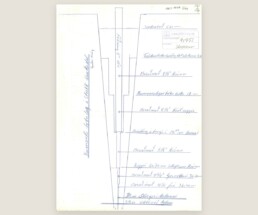
Strokkur: Why It Stopped Erupting - and the 1963 Drilling That Brought It Back
The short answer
Strokkur stopped erupting in the autumn of 1896, when earthquakes in South Iceland shifted the plumbing beneath the Haukadalur hot spring field. For sixty-seven years it did almost nothing. On 16 July 1963 a state drilling rig arrived from Selfoss with orders to wake it up. It took eighteen days. At 39 metres, on 23 July, the hole erupted with such force that nobody could get near the rig. Strokkur has erupted ever since.
What you see today
Strokkur goes off every few minutes — roughly nine times an hour, with something like seven minutes between eruptions on average. The crowd stands in a loose ring behind the rope, phones up, and waits. The water swells into a blue dome a second before it goes, which is the moment everyone is trying to catch and mostly misses.
It is the most reliable geyser in Iceland, and reliability is why it sits on every Golden Circle itinerary in the country, alongside Þingvellir and Gullfoss. What almost nobody standing there knows is that the reliability is recent, and that it was arranged.
Geysir and Strokkur are not the same hot spring
This trips up most visitors, and a fair amount of published writing too.
Geysir — the original, the one that gave every geyser in every language its name — is dormant. It has been more or less quiet for decades. What you see there now is a large, still, steaming pool.
Strokkur is a separate hot spring a short walk away. Smaller, and the one actually erupting. Nearly every photograph captioned “Geysir erupting” is Strokkur.
The two are connected underground, and their histories run against each other: through the recorded past, when one has been active the other has tended to be quiet.
Before 1789 — blocked on purpose
The idea of intervening at Strokkur is not modern.
In 1708 Strokkur was deliberately blocked with turf and stones. The reason was agricultural: it was damaging the hayfield at Laug, the farm alongside the hot spring field. A hay meadow was worth more than a spouting hole in the ground.
Worth holding onto that, because the question people ask about 1963 — whether it is acceptable to interfere with a natural feature like this — was answered by the people who lived here 255 years earlier, in the other direction.
1789 — the earthquake that opened it
In 1789 a strong earthquake struck the region and Strokkur began erupting powerfully.
Four years later, in 1793, the naturalist Sveinn Pálsson recorded the geyser and its name. Strokkur means “churn” — the wooden butter churn, with its plunger driven up and down. Anyone who had made butter recognised the motion immediately.
The nineteenth century
The nineteenth-century record is a list of heights, and it reads like a decline with interruptions.
1804: around 45 metres, with Geysir reaching 65. 1809: 45 metres again, sustained for something like an hour and a half. 1810: 24 metres. 1815: over 60. By 1830 it was clearly weakening. In 1863 it managed 15 metres — but that eruption was induced, with gravel. By 1871 there was virtually no natural activity at all. In 1880 it was back to 25 or 28 metres.
That word induced is the part usually left out. For much of the nineteenth century Strokkur erupted mainly when people made it. Turf and gravel were thrown into the conduit to choke it and force a reaction, and visitors who had travelled a long way expected a show. The later soaping of Geysir was the same instinct with better chemistry.
So by the time anyone arrives at 1963, the site already has a two-hundred-year history of people reaching into it — first to stop it, then to start it.
1896 — the earthquakes that closed it
In the autumn of 1896 a sequence of earthquakes struck South Iceland, and the hot spring field rearranged itself.
Strokkur stopped almost completely. Geysir took over, erupting powerfully for the next two decades — which is precisely the period when Geysir’s international fame was established.
You will see 1907, 1920 and vague phrases like “around the turn of the century” given as the date Strokkur went quiet. Those are wrong. The event is the 1896 earthquake sequence, and the local record is clear about it.
Dormancy, 1896–1963
Sixty-seven years.
Over that time the water level in the conduit fell steadily. In 1931 the water stood about a metre below the surface, with a surface temperature of 80.5 degrees. In 1937 the conduit was measured at 11 metres.
The clearest description of what it had become comes from Kristbergur Jónsson, who lived at Laug. He described a hole around 12 metres deep, narrowing as it went, with no standing water — only a small pool at the very bottom. Part of that account he had from his mother.
That is what was there in the summer of 1963. Not a geyser. A hole with rubble in it.
I met his son. Jón Kristbergsson lived in a turf house that is still standing near Strokkur, and my father took me there when I was eight or nine years old. My father was a tall man and had to bend to get through the doorway. We sat inside and drank black coffee. I was too young to ask him about Strokkur, which I have regretted since.
What I remember is him telling my father how strange he found it that the tourists coming to watch Strokkur had no idea the whole thing was partly man-made. He had been alive when it was not erupting. I do not remember his exact words — I was a boy, and it was a long time ago — but that was the sense of it, and it stayed with me.
16 July 1963 — the rig arrives
Everything written about the 1963 drilling until now has come down to a sentence: locals cleared the blocked conduit on the advice of the Geysir Committee.
The men who did it kept a daily log. Fifteen sheets, one per working day, handwritten in ballpoint on the printed forms of Rafmagnsveitur ríkisins, Jarðborunardeild — the State Electricity Authority’s drilling department. Each one is signed at the bottom by the rig foreman: Þórir Sveinbjörnsson. The same three men are listed alongside him on nearly every sheet — Ólafur J. Jónsson, Reynir Guðmundsson, and a Sigurðsson whose first name I cannot read with confidence.
Those are the “locals.”
The first sheet is dated 16 July 1963. No drilling was done. They moved the rig up from Selfoss, laid water pipes and set up pumps, and the foreman wrote down what they had come to do:
Borinn fluttur frá Selfossi að STROKK í Haukadal, en gera á tilraun með að laga hverinn og vekja hann til lífsins aftur, en hann hefur legið að mestu niðri frá því fyrir 1896.
The rig moved from Selfoss to Strokkur in Haukadalur, to attempt to repair the spring and wake it back to life, it having lain mostly dormant since before 1896.
Note the date in that sentence. In 1963 the men standing at the spring knew perfectly well when it had stopped. It is the modern sources that lost it.
The next day they tried to pump the spring out and found it too hot to work with — 83 degrees. They gave up on pumping, built a timber platform over the hole, and started to drill. By evening they were at 19.5 metres, and the foreman recorded what was down there:
Hitt nú er á vatn 1.60 m. Dýpi í hver 5.60 m. Rusl í botninum frá 5.60 m niður í 12 m.
Water at 1.60 m. Depth of the spring 5.60 m. Rubble in the bottom from 5.60 m down to 12 m.
Those are exactly the figures the local histories give. Here they are in the hand of the man who measured them.
The week when nothing worked
By 19 July they were at 36.4 metres and there were signs of something happening — steam showing from 34 metres down. They pulled the drill string and the hole spat out the water standing in it, with a trace of steam. It was not enough.
So they tried everything else. They took the casing back out. They poured in soap. They added carbide. Nothing.
The next day, 20 July, is the sheet that changes the story:
Gerðar miklar tilraunir til að fá Strokk til að gjósa, en vegna fyrirmæla um að fara “sérstaklega varlega” þá vildum við ekki bora meira í bili fyrr en fullreynt væri hvort hægt væri að ná hvernum til að gjósa. Sett var sápa 45 kg. Sett úr karbít — mikið, en allt kom fyrir ekki.
Great efforts made to get Strokkur to erupt, but because of instructions to proceed “especially carefully” we did not want to drill any further for the time being, until it had been fully tested whether the spring could be made to erupt. 45 kg of soap was added. Carbide added — a great deal — but none of it did any good.
Read that twice. The 1963 drilling is usually told as an era that simply did things. It was not. Somebody gave these men an instruction to go especially carefully, and the foreman thought the phrase worth putting in quotation marks. They stopped drilling and spent three days trying to avoid it.
And they soaped Strokkur. Forty-five kilos. The soaping of Geysir is a well-worn story; nobody mentions that the same thing was tried on Strokkur first, and that it failed.
They went home for the weekend. They came back on Monday 22 July and tried the soap again, and pumping again. The spring sat there, brim full, trickling slightly over the edge, and did nothing.
23 July — 39 metres
On the Tuesday they went back down.
Borað með 4¼” krónu niður í 39.40 m, en í 39. m gaus holan mjög öflugu gosi.
Drilled with a 4¼” bit down to 39.40 m, but at 39 m the hole erupted with a very powerful eruption.
They stopped at 39.40 metres. Not because the hole was finished, but because it was no longer possible to get near the rig. They tried to pull the drill string out and managed nine metres before the spring began spitting up under the platform and through the gaps in the boards — while water was being pumped into it at eight to ten litres a second to hold it down.
Sixty-seven years of nothing, a week of soap and carbide and pumping, and then three metres of rock.
The last week — getting the pipe out
What follows in the log is not triumph. It is a week of hard, awkward work trying to get their own equipment back out of an erupting geyser.
They pumped in 15 to 20 litres a second and it was not enough. They mixed heavy drilling mud and pumped that down; the hole threw it straight back. They tried Fiberlex. Same. On 29 July the foreman wrote, with what reads like a mixture of exasperation and admiration:
Hverinn er stórkostlegur vegna gosa uppi gegnum pallinn sem er ofan á hvernum.
The spring is magnificent, erupting up through the platform that is on top of it.
The steel casing — 19.4 metres of 5-inch pipe — was stuck fast. It took them from 25 to 31 July to get it out, and when it finally came free it came up in one piece. This matters, because it means there is no pipe left in Strokkur. The hole is open rock.
That same day, 31 July, the rig was taken away and the platform dismantled. The foreman’s last line on the sheet:
Upp vakinn Strokkur er að vísu skítugur, en gosin eru kröftug ef hverinn fær nóg vatn.
Strokkur, woken up, is admittedly dirty, but the eruptions are powerful if the spring gets enough water.
Two days of clearing up followed. And then, on 3 August, the last sheet records something nobody writing about Strokkur has mentioned since. As the old basin filled and the water level rose, the eruptions changed character: they came further apart, and they got bigger.
Þegar vatnið hækkaði í hvernum þá hækkuðu gosin um leið og urðu strjálli, allt frá því að vera 30 sekúndur á milli gosa upp í 10–15 mínútur milli gosa, og þá komu einka 40–50 m gos. Veður var stillt og auðvelt að bera saman við borsmastrið.
As the water rose in the spring the eruptions rose with it and became less frequent, going from 30 seconds between eruptions to 10–15 minutes, and then came eruptions of some 40–50 m. The weather was calm and it was easy to compare against the drill mast.
Forty to fifty metres. Measured against their own rig mast, on a still day, in the first week of August 1963.
The hole, as recorded
| Borehole number | 91751 |
| Location | Haukadalur — Strokkur í Haukadal |
| Operator | Rafmagnsveitur ríkisins, Jarðborunardeild |
| Rig foreman | Þórir Sveinbjörnsson |
| Drilling began | 16 July 1963 |
| Drilling completed | 3 August 1963 |
| Method | Straight hole |
| Final depth | 39.4 m |
| Widths | 0–19.5 m: 215.9 mm · 19.5–26.7 m: 130.175 mm · 26.7–36.4 m: 120.65 mm · 36.4–39.4 m: 107.95 mm |
| Casing | 5″ to 19.4 m, removed 31 July 1963 |
| First eruption in the hole | 23 July 1963, at 39 m |
| Coordinates | 64° 18′ 45.49″N, 20° 18′ 2.88″W |
Since 1963
Strokkur has erupted continuously since that August, and it is the borehole that made it dependable rather than occasional.
Measurements since: a flow of about 2.5 litres per second in 1967, and roughly 2 litres per second measured for Iceland’s Nature Conservation Council on 17 September 1994, with water temperature at depth somewhere around 120 to 125 degrees.
It no longer throws water forty metres. What it does instead is go off nine times an hour, every hour, in every weather, which is worth more to a coach schedule than any single spectacular column.
The old habits took a while to die. Geysir was still being coaxed into performing after 1963, and the method was the same soap that had failed at Strokkur — poured in to lower the surface tension and set off an eruption on demand, usually for an audience.
My sport teacher at grammar school was one of the men who soaped Geysir. He went up at night, because it was not really permitted.
The site is now protected. Since 17 June 2020 it has been a protected natural monument, and interventions of the 1963 kind are no longer on the table.
So is Strokkur man-made?
Partly. Honestly, yes, partly.
The heat is natural. The water is natural. The conduit is natural, and it erupted on its own for long stretches of the eighteenth and nineteenth centuries. But the Strokkur you watch today — the one that goes off nine times an hour, reliably enough to build a tour schedule around — exists in that form because four men drilled 39.4 metres into it in the summer of 1963. Without that, it would be a small pool. Roughly what Geysir is now.
That is not a scandal, and it is not a secret. It is the continuation of something that had been going on at this site since at least 1708: people blocking it, choking it, throwing turf into it, soaping it, drilling it. The 1963 borehole is the most successful thing anyone has done to it, not the first.
What strikes me, having read the log, is that they were not reckless. That was what I expected to find and it is not what is there. They had orders to go especially carefully and they followed them — they stopped drilling for three days and tried every gentler thing they could think of first. Only when the pumps and the soap and the carbide had all failed did they go back down, and then it worked immediately.
Nobody would do it now. Geysir sits quiet a short walk away, and the reason nobody drills it is that the ground underneath is not well enough understood to know what a borehole would do to the rest of the field. That caution has been argued out in public, in the newspapers, over years.
So the difference between 1963 and today is not that they were careless and we are careful. They were careful. The difference is that in 1963 being careful still ended with a decision to drill, and a geyser that has run for sixty-three years. I am not sure the modern answer is wrong. But it is worth saying plainly what the cautious answer would have cost in 1963: Haukadalur would have two silent pools and nothing to watch.
A note on the record
None of this was hidden. The drilling reports have been sitting in a public state archive the whole time, scanned and free to download, findable by anyone who thought to look for a borehole rather than a geyser.
The gap in the English-language record was never a missing document. It was that everybody copied everybody else.
Two things in the record I have not been able to settle. The national borehole registry names the rig as Ýmir; the daily sheets appear to name a different rig. And the registry gives the operator as Jarðboranir ríkisins, where the sheets are printed with Rafmagnsveitur ríkisins, Jarðborunardeild. I have left both out of the account above rather than guess. If you know the answer, or if you have a photograph of the work — no image of the 1963 drilling has surfaced anywhere — I would like to hear from you.
Sources
Borskýrsla — daily drilling reports, Strokkur, 16 July – 3 August 1963. Rafmagnsveitur ríkisins, Jarðborunardeild. 15 sheets plus cross-section. Digitised by Orkustofnun:
Daily reports, July–August 1963 (PDF)
Borehole cross-section, 8 August 1963 (PDF)
Borholuskrá — the national borehole registry, Umhverfis- og orkustofnun. Borehole 91751, Strokkur í Haukadal.
Ingólfur Guðnason, “Strokkur og hverasvæðið í Haukadal”, Litli-Bergþór, magazine of Ungmennafélag Biskupstungna.
Helgi Torfason, article on Strokkur in Eyjar í eldhafi (1995), festschrift for Jón Jónsson.
Helgi Torfason, “Geysir vakinn upp”, Náttúrufræðingurinn 53 (1–2), 1984, pp. 5–6.
Ísleifur Jónsson, “Hvers vegna sefur Geysir?”, Morgunblaðið, 22 July 1997, pp. 26–27.
Umhverfisstofnun, Stjórnunar- og verndaráætlun — Geysir 2022–2031.
How to actually improve your chances of seeing the northern lights in Iceland
First: come for Iceland, treat the lights as a bonus
This is the single most important shift in mindset, and it changes everything.
Come to Iceland for Iceland — the waterfalls, the black beaches, the glaciers, the steam rising off the ground, the empty roads through landscapes that don’t look real. Enjoy that. Then treat the northern lights as a wonderful bonus on top, not the reason the trip succeeds or fails.
People who come only to see the aurora often go home disappointed, because they pinned an entire trip on something no one controls. People who come to experience Iceland, and stay ready for the lights, tend to go home happy either way — and they’re the ones who actually catch the aurora more often, because they’ve built their trip the right way.
So the goal is simple: enjoy the journey through Iceland, and shape that journey so the bonus becomes as likely as possible. That’s exactly what we try to do.
Why being on a rental car matters
If you base your whole trip on day-tours out of Reykjavík, you’ll spend most of your time in and around the city. Those tours can be excellent — this isn’t a knock on them. But the trade-off is real: you end up seeing a fraction of the country, because you keep returning to the same base each night.
Being on a rental car and travelling around the country is a different kind of freedom. You see far more of Iceland by day, you stay in the countryside at night, and — crucially for the aurora — you can move. More on why that matters in a moment.
To be completely fair: staying in Reykjavík and taking evening aurora tours is a perfectly valid choice. It’s simpler, and you don’t drive. It’s a genuine option, and for some people it’s the right one. But if you want to both see more of Iceland and improve your aurora odds, self-driving gives you both. It’s a choice, and I want you to make it with open eyes.
The day is for seeing. The evening is when the opportunity opens.
Here’s the rhythm that matters.
During the day, you explore and enjoy. The aurora isn’t a daytime event, so daytime is simply for experiencing Iceland.
The opportunity opens in the evening, usually starting around 7–8pm and lasting until 4–5am, with midnight being the statistical peak based on the research. So the period that really matters is after you’ve arrived at your hotel for the night. That’s the window. And being ready in that window is what separates a good chance from a missed one.
This is exactly why, on our self-drive trips, we analyse the area around each hotel we use — and tell you where you could go that evening. Sometimes it’s worth driving a short distance to get out of light pollution. Sometimes there’s a beautiful spot nearby that makes a stunning backdrop for photos. Every hotel is different, so we look at each one through that lens and give you the local knowledge in advance.
Understanding the forecast — and the clouds
People often think the aurora forecast is the whole story. It isn’t.
A geomagnetic storm can hit and the activity can be high — but you still have to actually see it, and clouds are usually the hardest problem. The lights can be dancing brilliantly above a thick cloud layer and you’ll see nothing.
This is the real reason being on a car matters so much. If clouds sit over your hotel, you want to be able to drive — even one or two hours — to find a clear patch of sky. A fixed base can’t do that. Mobility is the single biggest practical advantage you have against clouds.
So when you’re at your hotel in the evening: check the aurora forecast (activity level and cloud cover both). Talk to reception — they often know the local conditions and the best nearby spots. And ask about an aurora wake-up call. This one is genuinely important: many good hotels will wake you if the lights appear, so you can sleep without stress and not miss a sudden display. Because here’s the truth — it often happens unexpectedly, even when the forecast said otherwise. It’s nature; you can’t use science to predict it 100%.
That readiness — being on a car, watching the forecast, talking to locals, having a wake-up call — is what turns “we got unlucky” into “we were ready when it happened.”
So why we believe self-drive is the best way
Putting it all together: a self-drive trip lets you see far more of Iceland by day, puts you in the countryside (often darker skies) at night, and — most importantly — gives you the mobility to chase clear skies when clouds get in the way. Paired with knowing where to go around each hotel and being ready in the evening, that’s the strongest position we know how to put you in.
We can’t promise the aurora. But we can do everything within our power to improve your chances — and help you be ready when the moment comes.
Doing it safely (please read this part)
Being mobile is your biggest advantage, but only if you do it safely. A few things I ask of everyone:
Be on a good 4×4. Weather and road conditions in Iceland can change fast, especially in winter. A capable vehicle isn’t a luxury here — it’s safety.
Always put safety first. If conditions are bad, the aurora is not worth a risk. It will come another night.
Tell reception your plans before you head out in the evening.
Keep the road-assistance number ready in case something happens and you end up waiting in the car for a while. Have warm clothing, water, and a charged phone.
And one thing locals will thank you for: never park in the middle of the road. People do this — they stop on the road and wander around in the dark to watch the lights — and it’s genuinely dangerous, because other drivers can’t see them. Always pull your car fully off the road into a proper spot, so you’re not a hazard to anyone while you wait for the aurora to dance.
Come for Iceland. Stay ready for the lights. Do it safely and respectfully. That’s the honest formula — and it’s the one we build every self-drive trip around.
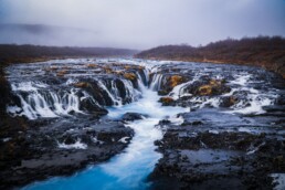
Your Comprehensive Guide to Unveiling Iceland's Golden Circle
The Golden Circle is a loop of roughly 300 kilometers east of Reykjavík connecting three places: Þingvellir, the Geysir hot spring area, and Gullfoss. It is the most driven route in Iceland and usually the first thing visitors do.
Here is what the name hides: this is not a scenic reserve. It is a working agricultural district. The road between the famous stops runs past dairy farms, sheep farms, greenhouses and a school, and the people on it are mostly going to work. My family has lived and farmed in Biskupstungur, the district that holds most of this route, since 1935.
This page is the overview: distances, road conditions, where the crowds come from and how to stay out of them. The history of each place is deeper than a paragraph can carry, so I keep the history short here and link to the full accounts.
What the Route Actually Is (Logistics & Driving)
From Reykjavík to the first stop, Þingvellir, is about 47 kilometers — roughly 45 minutes. The full loop is around three to three and a half hours of pure driving. With the three main stops, it fills a day.
The main loop is paved the whole way. In summer, any car does it, and the only planning you need is a fuel tank and patience at the car parks. Winter is the same road with different rules: daylight shrinks to a few hours in December, the surface ices, wind matters more than snow, and a few times each winter the road simply closes. Check road.is and vedur.is the morning you go, not the night before. If the locals are not driving, you should not be either.
There is a difference between driving a landscape and understanding a community. You can drive this loop and collect three sights. Or you can notice what is between them: hay fields, cattle sheds, steam rising out of farmland, tractors and school buses using the same road you are. Every sign you pass is a farm name, not an attraction. Most visitors drive through the district to photograph three points in it. The rest of this site exists for the difference.
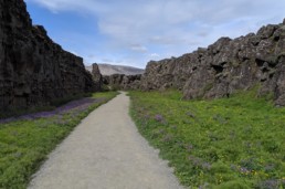
The Main Stops (And What the Brochures Miss)
Þingvellir National Park
Þingvellir is a rift valley where the North American and Eurasian plates pull apart — the cliff you walk beneath is the edge of North America — and it is where Icelanders founded their assembly in 930, which is why it is both a national park and a UNESCO site. The reality on the ground: you pay for parking, the main route through the gorge is a wide managed path, and from mid-morning until after lunch it moves at the pace of the slowest tour group on it. The park is much larger than that one path.
Read the real history of Peningagjá and the working farm roads here.
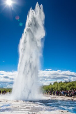
Geysir and Strokkur
Geysir — the hot spring every geyser on earth is named after — is dormant, and has been for a long time, so do not build your visit around seeing it erupt. Strokkur, a short walk away, is the one that erupts, every few minutes, all day. At midday the rope around it holds a crowd several deep, most of them filming; the eruption lasts seconds, and the wait between eruptions is when you actually look at the place.
Read the history of the 1963 drilling that brought Strokkur back to life.
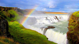
Gullfoss
Gullfoss is the Hvítá, a glacial river, going over two steps — about 32 meters — into a canyon. You hear it from the car park; on the lower path the spray reaches you, and in winter that spray freezes and the lower path often closes. It has the biggest car park on the route and, at midday, the fullest. Give it more time than the buses do, if the weather lets you.
Read the history of the Brattholt farmers and the Hvítá river here.
The Timing Problem (Escaping the Wave)
Nearly every scheduled tour leaves Reykjavík between 8:00 and 9:00 in the morning. That puts thousands of people onto the same loop, in the same order, at the same hours: Þingvellir by mid-morning, Geysir at lunch, Gullfoss in the early afternoon. The sites are not too crowded. The schedule is.
The wave has an end. By mid-afternoon the buses turn back toward the city for dinner, and the same viewpoints empty out while there is still usable light. If you control your own schedule, invert it: start behind the wave, not inside it.
Beyond the Big Three
The district does not stop at the three car parks. Laugarás is a geothermal village on the Hvítá where the heat comes out of the ground and gets used — for bathing and for growing. Skálholt, across the river, held the seat of Iceland’s bishops for centuries; more of this country’s history ran through it than through most places the buses stop, and most buses drive past it. The greenhouses around here grow a real share of Iceland’s vegetables on geothermal heat — you can eat a tomato raised a field away from where you are standing. And Brúarfoss, a smaller spring-fed waterfall just off the same loop, has a full guide of its own.
Explore more of the district in The Untold Stories of the Golden Circle.
Where to Stay (Why Day Trips Fall Short)
A day trip spends its best hours on the highway. Leaving the district around 5:00 PM means you were only there when everyone else was — and you sit in a car through the evening, which is when the sites are empty, the light is low, and, in winter, when the northern lights become possible.
The fix is not complicated: sleep in the district. There are farm guesthouses, hotels and campsites along the whole loop, and any of them puts you at the sites before and after the wave instead of inside it. Full disclosure: we run one of the options ourselves — a bubble hotel in a forest a short drive from Geysir — so weigh anything I say about it accordingly. A full, honest review of a winter night in one of the bubbles — including the parts people do not enjoy — is coming to this page soon.
Supermarkets & Groceries in Iceland: 5 Things you should know
Supermarkets & Groceries in Iceland: 5 Things you should know
By Michael Chapman
Supermarkets & Groceries in Iceland: 5 Things you should know
Which supermarkets in Iceland are best for travellers on a budget? What kind of food is available for purchase, and what hours are stores open? Read on to find out five essential things you should know about supermarkets and groceries in Iceland.
Among the most commonly shared facts about Iceland is its expensive cost of living, especially when compared to other countries across Europe. When it comes to Iceland grocery shopping, the story is not too much different; you’ll likely find the prices more than you’d initially expect.
Icelanders rely on imported goods, everything from clothes to electronics and snacks. As you can imagine, this means that each item comes at a more significant expense, which is often a shock for guests accustomed to cheaper locales. Fear not, though; whatever Iceland grocery store you visit, you are sure to find all you need available to purchase on their shelves.
Buy Iceland groceries to keep within your travel budget
Wallet-conscious travellers need to know how to keep their costs down when in the land of ice and fire. One of the best methods of mitigating your expenses is purchasing food, drink and other necessities from any of Iceland’s supermarkets. For the purposes of this article, when we mention buying some Iceland grocery, we are referring to shops throughout the country, rather than Iceland supermarket specifically.
In fact, grocery shopping in Iceland should be considered a necessity, whatever your budget. Preparing your meals is always a cost-effective option, especially considering the prices in petrol stations and other small shops located on the Ring Road. For example, a mere soda and hot dog will likely set you back $15 USD, or £11 GBP. Who really needs that when the budget is already stretched?
Given the costs you’ll already be putting forward for accommodation, vehicle rentals and activities, it’s much wiser to keep conscientious about your food purchases throughout the holiday period. That’s not to say you shouldn’t head out to explore Iceland’s fine dining restaurants, but eating out should be thought of as a treat if you hope to return home with any cash at all.
The cheapest supermarkets in Iceland are Bonus and Kronan
The two largest and cheapest chains are Bonus and Kronan, the latter coming out as just a tad more expensive. Iceland groceries don’t come more bog standard than this, making both supermarkets a favourite for residents and visitors alike.
Note that there hasn’t been a price test conducted over all supermarkets in Iceland since 2019, so costs will likely differ year to year. If you have any doubt as to the price of an item, you can often scan its barcode at one of the many price-check outlets situated around the store.
However, rest easy knowing Bonus and Kronan are always the go-to supermarkets if you’re looking to save the pennies. Getting your fill of Iceland grocery doesn’t need to break the bank!
Both supermarkets promote a bright yellow colour scheme and can be found close by to most major urban settlements in the country. You’ll know you’ve arrived at a Bonus if you see their pink Piggy-bank mascot, while a smiling coin represents Kronan.
Bonus and Kronan offer a wide selection of food and drink items, though they differ in brands. All necessities are available to purchase; fresh fish and meats, cheeses, milk, bread, fruits and vegetables. Any extra items you might need, from toothbrushes to sunscreen to sunglasses, can also be located at either store.
PLAN YOUR JOURNEY
Travelling to Iceland?
Check our overnight tours with a driver guide that includes a one night stay in a bubble.*Starting from ISK 74.900 per person

There are a range of other supermarkets in Iceland

Netto is a mid-scale supermarket that offers a wide variety of food, drinks and goods. It is not much more expensive than Bonus and Krona, so it makes for a suitable alternative that should be far away from the cheaper markets. In addition, many Netto stores stay open throughout the night, making this a good choice for those who arrive in Reykjavik in the early hours of the morning.
Hagkaup is the supermarket that branches off from just food, offering clothes, toys, cosmetics, garden furniture and many other items. In this way, the store resembles a mall more than your average grocers, and you can spend a decent half-hour perusing the many wares on offer.
10/11 is one supermarket to be avoided as it almost entirely catered to tourists or those too lazy to walk an extra half-mile to a cheaper store. While there is very little difference in the wares offered, the price differentiation is astronomical and without consistency from store to store.
Krambudin is much the same, though a different company owns it. However, if you do plan on shopping here, expect your bill to be around 50% higher. So why not ask yourself, are you so flush with cash that you don’t mind being robbed in broad daylight? No, we thought not. So best keep the purse strings tight, eh?
The supermarket chain ‘Iceland’ can also be found here, though there are far fewer stores than, say, in the UK or the rest of Europe.
Previous price tests have shown Iceland to be the most expensive supermarket in the country, which is odd considering its focus on frozen meals. However, having lived in this country for over five years now, I’ve never personally witnessed anyone shopping in an Iceland supermarket, which begs the question as to how they remain open.
Perhaps most guests forgive the expense in exchange for snapping a picture in front of the supermarket’s sizeable white lettering if only to add a fun, meta contribution to their holiday album. For those without much sense of humour, this could very well be the high point of your holiday abroad. Iceland in Iceland, after all… now that’s funny…
You can buy classic Icelandic food!

Grocery shopping in Iceland can be a fun activity in itself if you approach it with the mindset of trying out new and delicious meals.
For centuries, Icelanders relied on whatever food was available, mainly fresh fish, other seafood, and lamb. Over the years, these ingredients have been perfected and make up the foundations of modern Icelandic cuisine.
Skyr is another old yet widely popular dessert eaten every day by Icelanders, either as part of a healthy breakfast or a quick snack between meals. Though the plainest flavours boast a yoghurt consistency and taste, Skyr is a curdled cheese, similar to that eaten in Russia and Germany. Many people enjoy eating Skyr paired with oats and berries, while others are happy to eat it as is.
Another popular dish in Iceland is plokkfiskur, better understood as mashed white fish served with potato and, in some cases, cheese, with a side of buttered rye bread.
The Icelandic food listed above is just a handful of examples of what Icelanders commonly eat. For genuinely adventurous eaters, you’ll find more intimidating options in the form of liver sausage, fermented shark, or hanged meats.
You’ll find recognisable brands on sale in Icelandic supermarkets
Well, we’ve presented you with some ideas about what the Icelanders like to eat, but there’s always the chance you’re something of a philistine when it comes to eating overseas cuisine. If you are, fear not; there are hundreds of international brands ready for purchase and will bring with them all the comfort you’re used to at home.
For quick snacks on the road, you can grab crisp brands like Doritos, Pringles and Lays. If you are more of a sweet-tooth, you’ll find classic chocolates like Twix, Snickers, Oreos and Hersheys. While none of these are healthy, per se, they might give you a minor dopamine hit, a little reminder of home on your travels.
Of course, there are many other well-known brands beyond the world of snacks. For example, the world-famous Heinz company offers nearly its full range of sauces and tinned goods. UK visitors can also find the likes of Coleman’s Mustard and Branston Pickle, should they keep an eye out for them when browsing grocery stores in Iceland.
For travellers coming from beyond the west, there are many South-East Asian grocery stores in Iceland. Here, you can buy all manner of noodles, fish and rice dishes, and exotic ingredients you might not have expected to find on this lonely, sub-arctic island.
Other useful information about shopping in Iceland

Despite what you might think, Icelanders are busy people, so rely on self-checkout to get in and out of the shop quickly.
When it’s time to pay, you’ll likely find only a few cashiers on duty, so it’s best to scan the items yourself. Employees keep a keen-eye on the self-checkout machines throughout the day, so there’ll be no five-finger discounts unless you’re prepared to spend the night in a Reykjavik jail cell.
Self-checkouts bring us to another important point. Icelanders are bona fide plastic payers, meaning credit and debit cards are the go-to choice for transactions rather than cash. Many places across the country do not accept cash, so always be sure to keep your cards handy on your person when travelling.
Plastic bags are also no longer available in many supermarkets, with brown paper bags offered as an alternative. Be aware that these are also not free, and you will have to pay a few extra krona should you forget to bring your own bag with you.
In times of COVID-19, all grocery stores in Iceland have implemented hand sanitisers at their entrance. Though most restrictions have been lifted here, it is still important to keep distance between you and other shoppers.
While we’re taking notes, be aware that any product containing an alcohol level above 2.25% is not sold in Icelandic supermarkets. You can only buy beer, wine and spirits in state-run liquor stores.
Guests should also be aware that much of Iceland’s fruit and vegetable produce is imported, meaning it is far from fresh. This can be particularly irritating for vegetarians, vegans, or any traveller conscious of healthy eating habits.
One of the most disappointing shopping experiences that occurs regularly in Iceland, for instance, is to buy an avocado only to find at home that it has already begun rotting on the inside. Because of this quick degradation, shoppers should plan to eat their fruit and vegetables soon after buying them.
Opening Hours for Grocery Stores in Iceland

Below, you can find the opening hours for each of Iceland’s supermarkets. Do note, however, that opening hours for Iceland supermarkets are liable to change on holidays. Always make sure to check the company website before heading out to grocery stores in Iceland so as not to interrupt your travel plans.
Bonus:
(Monday – Thursday) 11.00 – 18.30
(Friday) 10.00 – 19.00
(Saturday – Sunday) 10.00/11.00 – 18.00
Kronan:
(Monday – Sunday) Hours differ between stores. See here.
Netto:
(Monday – Sunday) 09.00 – 21.00 or Open 24 Hours
Hagkaup:
(Monday – Sunday) Hours differ between stores. See here.
Iceland:
(Monday – Sunday) 07.00 – 12.00
10/11:
(Monday – Sunday) 24 Hours
Again, please be aware that opening hours for supermarkets in Iceland change from time to time, so always be sure to check the website before setting out.
In Conclusion
In conclusion, shopping at supermarkets in Iceland is sure to save a penny or two, as long as you’re aware of which shops boast the best prices. What Iceland grocery store you choose to visit is up to you!
Aside from the days you decide to eat-out at a restaurant or cafe, be sure to pack your lunches and snacks with items bought from either Bonus or Krona, or any other cheap Iceland grocery store you come across. Remember; you’re bound to get more bang for your buck when purchasing Iceland groceries over ready-made meals.
If late into the night you’re feeling peckish, or are in sudden need of bathroom necessities, 24/7 shops like Netto and 10/11 are your best bet. Though you might not think it considering the diminutive size of this country, grocery stores in Iceland mirror larger countries in being available for late-night buys.
Whatever the situation, there’s a supermarket, food mart, corner shop or grocery stores in Iceland that will provide you with all you need.
PLAN YOUR JOURNEY
Travelling to Iceland?
Check our overnight tours with a driver guide that includes a one night stay in a bubble.*Starting from ISK 74.900 per person

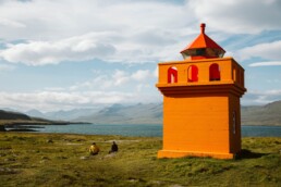
“10 Drops” of Icelandic Wisdom: Some of our favorite Icelandic sayings
“10 Drops” of Icelandic Wisdom: Some of our favorite Icelandic sayings
By Taylor van Biljon
Level up your Icelandic wisdom with some of these sayings and proverbs!
“10 Drops” of Icelandic Wisdom: Some of our favorite Icelandic sayings
By Taylor van Biljon
Level up your Icelandic wisdom with some of these sayings and proverbs!
Icelandic sayings, like all idiomatic and metaphorical language, are a reflection of the culture and the people that they belong to. Like a sort of touchstone throughout time, these sayings have been crafted from the experiences and known truths of the people that coined them- and though some of them may sound a bit mysterious to us now, their meanings reach back to us over the centuries- connecting us all once again through the story of shared existence.
A smá note before we head off on our journey:
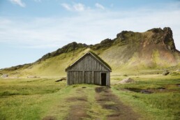
Humans love stories. We love to imagine ridiculous things, to dream up bizarre visuals and juxtapose the real with the unreal. It has always been one of the ways that we connect and anchor ourselves to this world, while reaching out to fellow souls.
Many of these sayings are great examples of that innate drive to create above all things. Imagine the power of some of these in a time before television! A chance to make some humor in a dark time, or to veer closer to a shared understanding. Is it with you, as it is with me?
It is easy to see how these attempts to connect to other people would have been popular, as they continue to be even now.
It is also good to note- that language travels with people, and is often historically changed by those movements. Though the Icelandic language did insulate itself fairly well for many years, there is always a chance that a saying was borrowed or adapted from another culture, or another meaning that has since changed over time. Iceland was settled by some of the most intrepid voyagers in this hemisphere, and despite being an island, visitors and returning residents continued to bring the treasures of their culture on their treacherous journeys.
We know the origin of some of these sayings, and some of them we can guess. But others are so ingrained in the colloquial speech of the day that they are just like ancient trees in the heath. We came here long after them- and we can only guess at the things they have seen.
It is that way with many of these- so if you have a scrap of knowledge to add, let us know! Despite their firm standing in the cultural lexicon of a place, it is also possible that interpretations of a proverbial meaning may vary. Half of the fun of these riddles of speech is in the discovery.
PLAN YOUR JOURNEY
Travelling to Iceland?
Check our overnight tours with a driver guide that includes a one night stay in a bubble.*Starting from ISK 74.900 per person
Saying: “að brynna músum”
Literal meaning: “to water the mice”
Intended meaning: to cry
We open our journey through some of our favorite Icelandic sayings with this one, a tiny yet colorful quip about crying. (Something that probably happened more often than not, back when the ownership of a single candle signified great wealth.)
Upon hearing this, it is hard not to be a bit charmed- but also to imagine the great scale at play. The picture of a giant human tear dropping down on a tiny mouse. So many cartoons come to mind! Some things never change, and I imagine that includes the need to inject a little humor into a sad situation, or, perhaps to poke some fun. So when you see somebody having a good cry, now you finally have something to say about it! (Or maybe not.)
Saying: “gera hreint fyrir sínum dyrum”
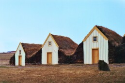
Literal meaning: “to clean one’s door” or “to clean the step to one’s door”
Intended meaning: to clean up your act or explain yourself
If you look for it, you’ll actually find this saying in regular circulation in the news. Typically it comes around when someone is behaving badly, and not owning up to it. You may know someone like that, yourself!
So feel free to reserve the use of this shameful rebuke on the next badly behaved entity that you find yourself interacting with; and let them know- go clean your door! There’s nothing like having the dirtiest door in the village to make you stop and reconsider your life path.
Saying: “Þar stóð hnífurinn í kúnni.”
Literal meaning: “there stands the knife in the cow” or “now the knife’s stuck in the cow”
Intended meaning: Now you’ve done it.
You will also find this little gem in the Icelandic news. A fitting sentiment for discussing the popular news of the day, this one certainly paints a picture. Imagine the context of this- “well, now you’ve really stuck a knife in the cow.” Denoting a discernible problem, this saying really makes you wonder.
In the long timeline of an agrarian society, were many knives lost in cows? Was it a regular occurrence to accidentally find one there? Maybe you were having a conversation with a neighbor, gesticulating wildly while searching for a vibrant enough phrase to describe a situation you found yourself in, and, well! The knife you were holding has been pulled by the cruel claw of gravity and physics, and is now sheathed in a nearby cow.
What a day. You needed this cow to last the winter. You do certainly have a problem, now. So does the cow. At least there will be steaks.
(21st Century tip: For us the working version of this problem proclamation would be: “Well now you’ve really stuck a knife in the Bubble.” Because that would indeed be somewhat of a problem for us.)
Saying: “rúsínan í pylsuendanum”

Literal meaning: “the raisin in the sausage end” or “the raisin in the end of the Icelandic hot dog”
Intended meaning: this phrase is used to describe a good surprise, or an excellent thing
Showing the mirror quality of sayings throughout cultures- this is a saying you may feel familiar with! Similar to the “cherry on top” or “it’s gravy/frosting” type sentiments, this is a way to describe an excellent thing. (While not delving too deeply into the various meanings of the gravy sayings, we understand that gravy can be a contentious and hallowed thing.)
Calling upon the imagery of finding a tasty treat inside a larger dish- (something that most culinary cultures experience in one way or another), this saying does come with its bit of puzzlement. Because.. A raisin? A raisin in a hot dog?
Our ancestors are all likely standing around scoffing at our spoiled palates, because if you can believe it, this was once a real treat. You’ve been eating this sausage, which let’s be very honest here- is probably already a treat- and behold! Just before you finished it, you discovered a rare raisin. An oasis of sweetness in what we must assume was a desert of a sausage. Euphoria follows, as one must expect.
..And while you are distracted by the divine excitement of the secret raisin, may we just sneak in the fact that this saying is believed to have been co-opted from the Danes, which.. Well we are going to need another raisin, is all we’re saying.
Saying: “Sjaldan er ein báran stök.”
Literal meaning: “Rarely is one wave single.” or “There is seldom a singular wave.”
Intended meaning: Good or back luck is often followed by more of the same
Interestingly enough, this is a sentiment that is known world over. Similar to the saying “bad things come in threes” or “when it rains, it pours”, there is a feeling in many cultures that extreme occurrences come with an entourage.
Recorded in Arngrímur Sigurðsson’s idiom compendium and translation dictionary, Íslenzk-ensk orðabók is one of the most reputable places that we can see this phrase recorded in published text. It is easy to imagine that this is a local saying, but as with many of these phrases- it is hard to know the true origin for certain.
Iceland has always been very focused on maritime trade and activity, and the ocean is an omnipresent visual here. Many things can be leveraged and compared this way- from the behavior of waves and currents, to the cruel realities of the power of the sea and the human life.
So much here is given by the ocean, but so much has also been taken away. It is a sobering reminder, that all coastal living folk do well to remember.
Saying: “að mála skrattann á vegginn”
Literal meaning: “to paint the devil on the wall”
Intended meaning: to exaggerate
Another favorite of the news, is this act of exaggerating during a clash of minds. Who hasn’t been ensnared in a hot disagreement, and then upped the stakes by adding some drama? Well, perhaps you, and many of your ancestors, that’s who.
Imagine the scene- you and some peers are trying to work through a situation, and then one of you flamboyantly interrupts the action by painting an actual depiction of the devil on the wall. What a move!
It is brassy to say the least, potentially annoying, and certainly a statement, which I think was your initial goal to begin with. This is a great saying, because it truly encapsulates the feeling that it is trying to touch upon.
When you make that decision to turn the heat up, you are painting the devil on the wall, my friend.
Saying: “að slá einhverjum gullhamra”
Literal meaning: “to hit somebody with a golden hammer”
Intended meaning: to compliment someone
A striking visual indeed, is hitting someone with a golden hammer. Bringing back memories of “hitting on someone”, “killing someone with kindness”, and countless others, is this golden description of complimenting someone. And it works, doesn’t it!
Receiving a compliment can be a tiny bit painful, despite the golden glow of it. Imagine the fleeting embarrassment of being told you’re cool, or attractive, or talented. Suddenly the wisdom of the hammer analogy is revealed.
Saying: “Ég skal sýna þér í tvo heimana!”
Literal meaning: “I shall show you the two worlds!”
Intended meaning: this is a threat
Ever told someone you were going to knock them into next week? Or that you brought them into this life, and could take them back out of it as well? Perhaps, “meet your maker” comes to mind?
There are so many good fightin’ words to choose from- but these are truly excellent. This saying originates from the belief that upon death, one transits between two worlds.
The realm of those of us who are alive, and the one for those of us who aren’t. There are other interpretations of this, including the belief that there are two specific afterlives. (Any of this sound familiar?)
There are some specifics here that we could debate all day, (including whose religion believes this- it does appear to span a few,) but the point you should be walking away with is that this is a really cool line. We’re not saying you should pick a fight in order to use it, but.. You have to admit it’s pretty incendiary.
Saying: “Gakktu hægt um gleðinnar dyr.”

Literal meaning: “Walk slowly through the doors of joy.”
Intended meaning: Don’t get too excited and hurt yourself.
It appears that “all things in moderation” rears its responsible head even here in Iceland. A popular genre of saying, older generations have been carefully repeating this one to younger generations since the dawn of time, and likely will not stop anytime soon. (I think each of us has had an experience at some point that will remind us why that is.)
This is an old phrase, and it’s so important that it even shows up in music! You can hear a song that includes it here.
A favorite explanation of this saying comes to us from author and journalist Alda Sigmundsdóttir. The way that she tells it does not feel too detached from today (especially after this past year and a half)- but it relies on the understanding that back then, there were less opportunities to gather and “cut loose”.
When these opportunities did come around, you can imagine how it went. Let’s dip into our imaginations and see if we can absorb the descriptive goodness from this treasure of a proverb.
Now, after drinking and making merry with the friends you haven’t seen in an age, perhaps you find yourself in a bit of a state. And perhaps, while enjoying the hospitality of the farm that you were all celebrating at, you attempted to leave the epicenter of music and dance to get a breath of fresh air and straighten yourself out or- you know, clean your own doorstep. Ahem.
But you were having too good of a time, you hit your head on the doorframe when you left, and you cracked it with your extreme enthusiasm and destroyed the exit.
So when you find yourself in the hopefully near future, enjoying a wild night out with some friends- take care to remember this wisdom of wisdoms, and pump the breaks a bit before you venture through any doors. In every way that one can imagine.
Saying: “tíu dropar”
Literal meaning: “ten drops”
Intended meaning: this is a type of amount exaggeration typically related to coffee, but not limited to coffee.
So you’ve made it all the way to the end, and you can see that the title finally ties into the article, and that all shall be revealed with great drama!
This is a popular fragment phrase that has lent its name to music, the name of a popular establishment in Reykjavik, and of course the daily lexicon of many Icelandic people. But what does it mean, these ten drops?
It is not an atypical practice in various cultures to go through a great fuss and prepare an impressive meal to provide hospitality to your visitor.
There are many reasons for this- the modern evolution of hostly manners, the relationship of resources to cultures that have known austerity, and the custom of knowing about this austerity, and therefore refusing the hospitality in order to avoid bringing more of it upon your host. Things like this change and imbed themselves in our interactions over time, but the memory of them is still with us.
You may have heard someone ask if you’d like a “spot of tea”, or “a bite to eat”. These are phrases that often accompany an offering, as it has been in recent times an acceptable thing to present these things humbly. Food and drink of course are vital resources, so it makes sense that we consider their value, even if things are going quite well.
This saying is a hallmark of Icelandic culture, and despite its minutia, it tells the story of a people who survived difficult days but celebrated togetherness despite them. It means ten drops, yes; but it means ten drops for a friend, no matter how many drops you have left, and that is a beautiful thing.
PLAN YOUR JOURNEY
Travelling to Iceland?
Check our overnight tours with a driver guide that includes a one night stay in a bubble.*Starting from ISK 74.900 per person
